File:Boston 1775.jpg

页面内容不支持其他语言。
這個文件來自維基共享資源
维基百科,自由的百科全书

原始文件(797 × 776像素,文件大小:250 KB,MIME类型:image/jpeg


摘要

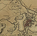
描述 Detail from

"A plan of the town and harbour of Boston and the country adjacent with the road from Boston to Concord, shewing the place of the late engagement between the King's troops & the provincials, together with the several encampments of both armies in & about Boston. Taken from an actual survey. Humbly inscribed to Richd. Whitworth by J. De Costa; C. Hall, sc."

hand colored map 37 X 49 cm.
日期
来源 Library of Congress Geography and Map Division Washington, D.C. 20540-4650 USA G3764.B6S3 1775 .D4 Vault g3764b ar090000 http://hdl.loc.gov/loc.gmd/g3764b.ar090000 "The Library of Congress is providing access to these materials for educational and research purposes and is not aware of any U.S. copyright protection (see Title 17 of the United States Code) or any other restrictions in the Map Collection materials."
作者 J. DeCosta

许可协议

Public domain

本作品在其来源国以及其他著作权期限是作者逝世后100年或以下的国家和地区属于公有领域


你必须增加美国公有领域标签显示为何这个作品在美国属于公有领域。

说明

添加一行文字以描述该文件所表现的内容
detail of a historical map of Boston from the American Revolutionary War

此文件中描述的项目

描繪內容

29 7 1775格里历

image/jpeg

7616e669ccf7958e5f3b41d450da4b7810c47ed4

255,754 字节

776 像素

797 像素

文件历史

点击某个日期/时间查看对应时刻的文件。

日期/时间缩⁠略⁠图大小用户备注
当前2006年8月7日 (一) 13:572006年8月7日 (一) 13:57版本的缩略图797 × 776(250 KB)Shauni{{Information |Description=Detail from thumb "A plan of the town and harbour of Boston and the country adjacent with the road from Boston to Concord, shewing the place of the late engagement between the Kin

以下页面使用本文件:

全域文件用途

以下其他wiki使用此文件:

元数据