
File:Central Europemap Pannonia Dacia and others.jpg
本预览的尺寸:778 × 600像素。 其他分辨率:311 × 240像素 | 623 × 480像素 | 996 × 768像素 | 1,280 × 987像素 | 2,560 × 1,974像素 | 3,717 × 2,866像素。
原始文件 (3,717 × 2,866像素,文件大小:1.11 MB,MIME类型:image/jpeg)
摘要
| 描述 |
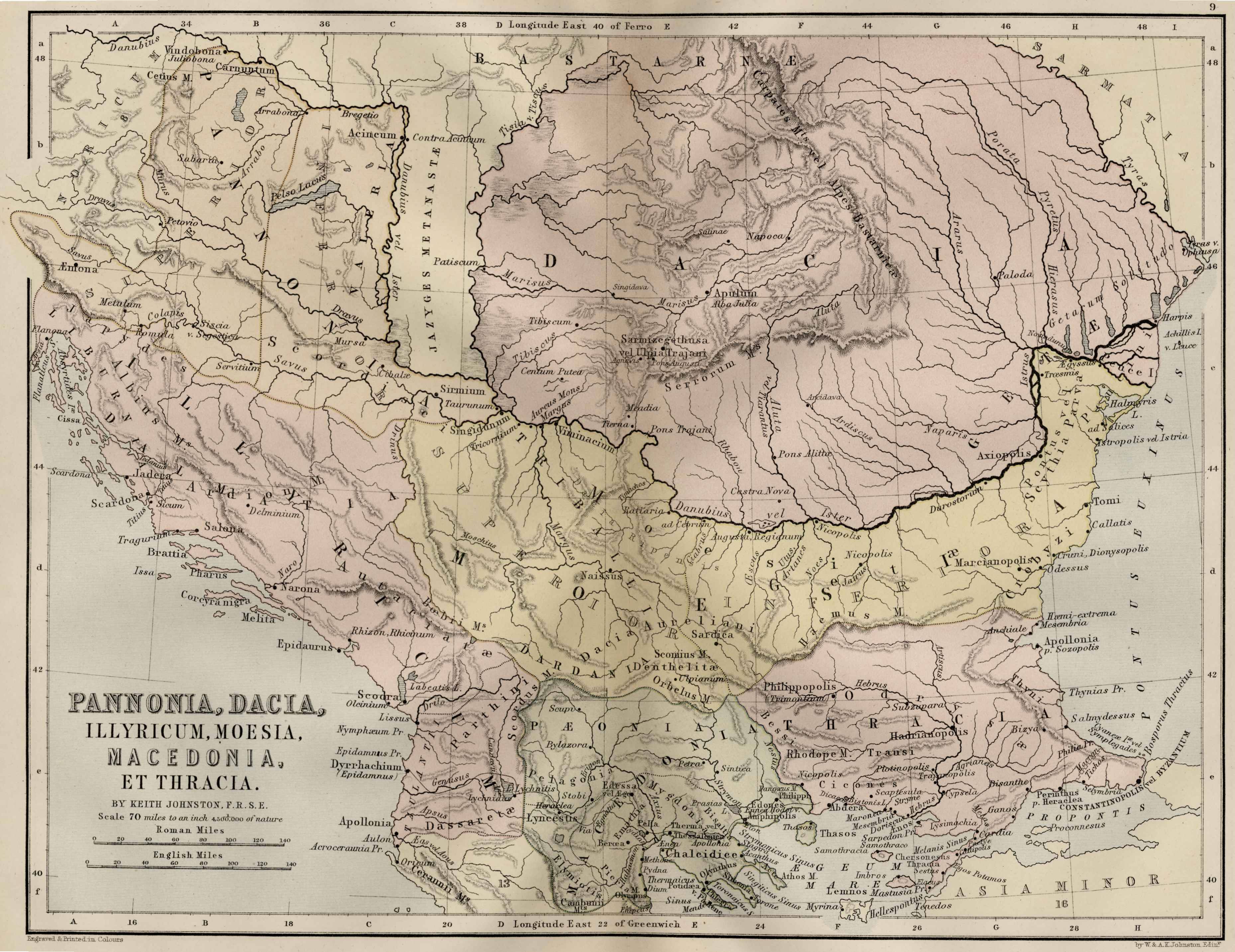
English: Map of Central Europe: Pannonia, Dacia, Illyricum, Thrace, Moesia, Macedonia and Thrace |
|||||||||||||||||||
| 日期 | ||||||||||||||||||||
| 来源 | http://ancienthistory.about.com/od/maps/ig/Ancient-World--Maps/Central-Europe-Map.htm | |||||||||||||||||||
| 作者 |
|
|||||||||||||||||||
| 授权 (二次使用本文件) |
|
|||||||||||||||||||
This map is in public domain and it comes from the 1886 Ginn & Company Classical Atlas by Keith Johnston (Map of Central Europe: Pannonia, Dacia, Illyricum, Thrace, Moesia, Macedonia and Thrace)
许可协议
|
本作品在其来源国以及其他著作权期限是作者逝世后100年或以下的国家和地区属于公有领域。 | |
| 本文件已被确认为免除已知的著作权法限制(包括所有相关权利)。 | |
文件历史
点击某个日期/时间查看对应时刻的文件。
| 日期/时间 | 缩略图 | 大小 | 用户 | 备注 | |
|---|---|---|---|---|---|
| 当前 | 2011年4月24日 (日) 15:46 | | 3,717 × 2,866(1.11 MB) | Boldwin | {{Information |Description ={{en|1=Map of Central Europe: Pannonia, Dacia, Illyricum, Thrace, Moesia, Macedonia and Thrace}} |Source =http://ancienthistory.about.com/od/maps/ig/Ancient-World--Maps/Central-Europe-Map.htm |Author =Alexa |
文件用途
以下页面使用本文件:
全域文件用途
以下其他wiki使用此文件:
- en-two.iwiki.icu上的用途