
File:GRAIL's Final Resting Spot.jpg
本预览的尺寸:800 × 469像素。 其他分辨率:320 × 188像素 | 640 × 375像素 | 1,024 × 600像素 | 1,702 × 998像素。
原始文件 (1,702 × 998像素,文件大小:1.39 MB,MIME类型:image/jpeg)
摘要
| 描述 |
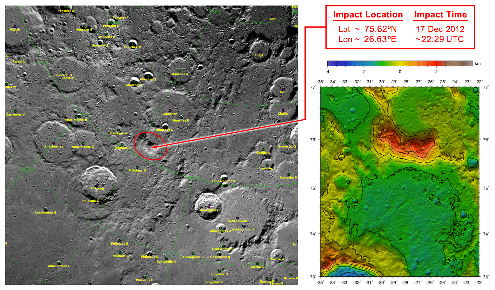
English: These maps of Earth's moon highlight the region where the twin spacecraft of NASA's Gravity Recovery and Interior Laboratory (GRAIL) mission will impact on Dec. 17, marking the end of its successful endeavor to map the moon's gravity. The two washing-machine-sized spacecraft, named Ebb and Flow, will impact at an unnamed mountain near the moon's North Pole.
These maps are from NASA's Lunar Reconnaissance Orbiter. |
| 来源 | http://www.nasa.gov/mission_pages/grail/multimedia/pia16603.html |
| 作者 | NASA |
许可协议
| 本文件完全由NASA创作,在美国属于公有领域。根据NASA的版权方针,NASA的材料除非另有声明否则不受版权保护。(参见Template:PD-USGov/zh、NASA版权方针页面或JPL图片使用方针。) | ||
 |
警告:
|
原始上传日志
原始描述頁面位於這裡。下列使用者名稱均來自en.wikipedia。
| 日期/时间 | 大小 | 用户 | 备注 |
|---|---|---|---|
| 2012-12-14 19:34 | 1702×998× (1460257 bytes) | RadioFan | Uploading a public-domain item using [[Wikipedia:File_Upload_Wizard|File Upload Wizard]] |
文件历史
点击某个日期/时间查看对应时刻的文件。
| 日期/时间 | 缩略图 | 大小 | 用户 | 备注 | |
|---|---|---|---|---|---|
| 当前 | 2014年9月18日 (四) 07:18 | | 1,702 × 998(1.39 MB) | Rcbutcher | Transferred from en.wikipedia |
文件用途
以下页面使用本文件:
全域文件用途
以下其他wiki使用此文件:
- ca.wikipedia.org上的用途
- en-two.iwiki.icu上的用途
- es.wikipedia.org上的用途
- ko.wikipedia.org上的用途
- ru.wikipedia.org上的用途