
File:Lake Abitibi 79.72W 48.75N.jpg

本预览的尺寸:778 × 599像素。 其他分辨率:312 × 240像素 | 623 × 480像素 | 997 × 768像素 | 1,280 × 986像素。
原始文件 (1,280 × 986像素,文件大小:510 KB,MIME类型:image/jpeg)
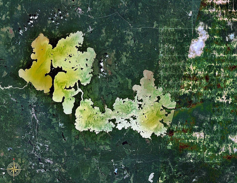
| 描述 | Lake Abitibi, Ontario and Quebec, Canada. The border between the 2 provinces is visible as a vertical line between undeveloped terrain in Ontario and the rectangular agricultural patterns in Quebec (the right/east third of photo). |
| 来源 | NASA WorldWind |
| 作者 | NASA |
| 本圖像屬於公有領域,因其為NASA的World Wind衛星地圖瀏覽器的一張截圖,且使用了公有領域圖層,如Blue Marble、MODIS、Landsat、SRTM、USGS、GLOBE等。
|
 |
文件历史
点击某个日期/时间查看对应时刻的文件。
| 日期/时间 | 缩略图 | 大小 | 用户 | 备注 | |
|---|---|---|---|---|---|
| 当前 | 2007年1月22日 (一) 17:23 | | 1,280 × 986(510 KB) | P199 | {{Information |Description=Lake Abitibi, Ontario and Quebec, Canada |Source=NASA WorldWind |Date= |Author= |Permission= |other_versions= }} {{PD-WorldWind}} Category:Lakes of Ontario Category:Lakes of Québec |
文件用途
以下页面使用本文件:
全域文件用途
以下其他wiki使用此文件:
- arz.wikipedia.org上的用途
- bg.wikipedia.org上的用途
- ceb.wikipedia.org上的用途
- de.wikipedia.org上的用途
- en-two.iwiki.icu上的用途
- eo.wikipedia.org上的用途
- es.wikipedia.org上的用途
- et.wikipedia.org上的用途
- fr.wikipedia.org上的用途
- hr.wikipedia.org上的用途
- it.wikipedia.org上的用途
- lv.wikipedia.org上的用途
- pl.wikipedia.org上的用途
- pt.wikipedia.org上的用途
- ru.wikipedia.org上的用途
- sv.wikipedia.org上的用途
- te.wikipedia.org上的用途
- uk.wikipedia.org上的用途
- www.wikidata.org上的用途