
File:Map Boulaide.PNG
此为最大尺寸。
Map_Boulaide.PNG (203 × 270像素,文件大小:6 KB,MIME类型:image/png)
摘要
| 描述 |
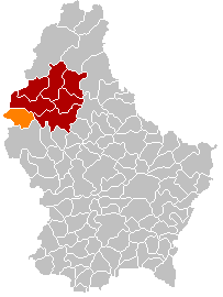
English: Own edit of Kanton WiltzLocatie.png |
| 日期 | 2005年10月18日 (原始上传日期) |
| 来源 | 无法识别来源。根据版权声明推断为其自己的作品。 |
| 作者 | 无法识别作者。根据版权声明推断作者为Markussep。 |
许可协议
| 我,本作品著作权人,释出本作品至公有领域。这适用于全世界。 在一些国家这可能不合法;如果是这样的话,那么: 我无条件地授予任何人以任何目的使用本作品的权利,除非这些条件是法律规定所必需的。 |
文件历史
点击某个日期/时间查看对应时刻的文件。
| 日期/时间 | 缩略图 | 大小 | 用户 | 备注 | |
|---|---|---|---|---|---|
| 当前 | 2018年1月8日 (一) 18:11 | | 203 × 270(6 KB) | NordNordWest | corr |
| 2018年1月8日 (一) 17:26 |  | 203 × 270(6 KB) | NordNordWest | upd | |
| 2015年11月10日 (二) 20:56 |  | 203 × 270(6 KB) | NordNordWest | no more districts in Luxembourg | |
| 2014年12月24日 (三) 16:47 |  | 203 × 270(3 KB) | Les Meloures | communes merged | |
| 2011年10月28日 (五) 13:03 |  | 203 × 270(3 KB) | Les Meloures | Something didn't work | |
| 2011年10月28日 (五) 11:25 |  | 203 × 270(4 KB) | Les Meloures | Replace map after creation of new municipalities in Luxembourg | |
| 2011年10月27日 (四) 22:43 |  | 203 × 270(3 KB) | Les Meloures | Change map after creation of new municipalities in Luxembourg | |
| 2006年5月3日 (三) 19:43 |  | 203 × 270(4 KB) | Markussep | ||
| 2005年10月18日 (二) 19:31 |  | 203 × 270(4 KB) | Markussep | own edit of Image:Kanton WiltzLocatie.png Category:Maps of municipalities of Luxembourg |
文件用途
以下页面使用本文件:
全域文件用途
以下其他wiki使用此文件:
- als.wikipedia.org上的用途
- da.wikipedia.org上的用途
- de.wikipedia.org上的用途
- fa.wikipedia.org上的用途
- it.wikipedia.org上的用途
- no.wikipedia.org上的用途
- pl.wikipedia.org上的用途
- pt.wikipedia.org上的用途
- ru.wikipedia.org上的用途
- sk.wikipedia.org上的用途
- sv.wikipedia.org上的用途
- tr.wikipedia.org上的用途
- uk.wikipedia.org上的用途
- zh-min-nan.wikipedia.org上的用途