
File:PIA17596-MarsCuriosityRover-AncientLake-20131209.jpg

原始文件 (3,300 × 2,550像素,文件大小:1.28 MB,MIME类型:image/jpeg)
摘要
| 描述 |
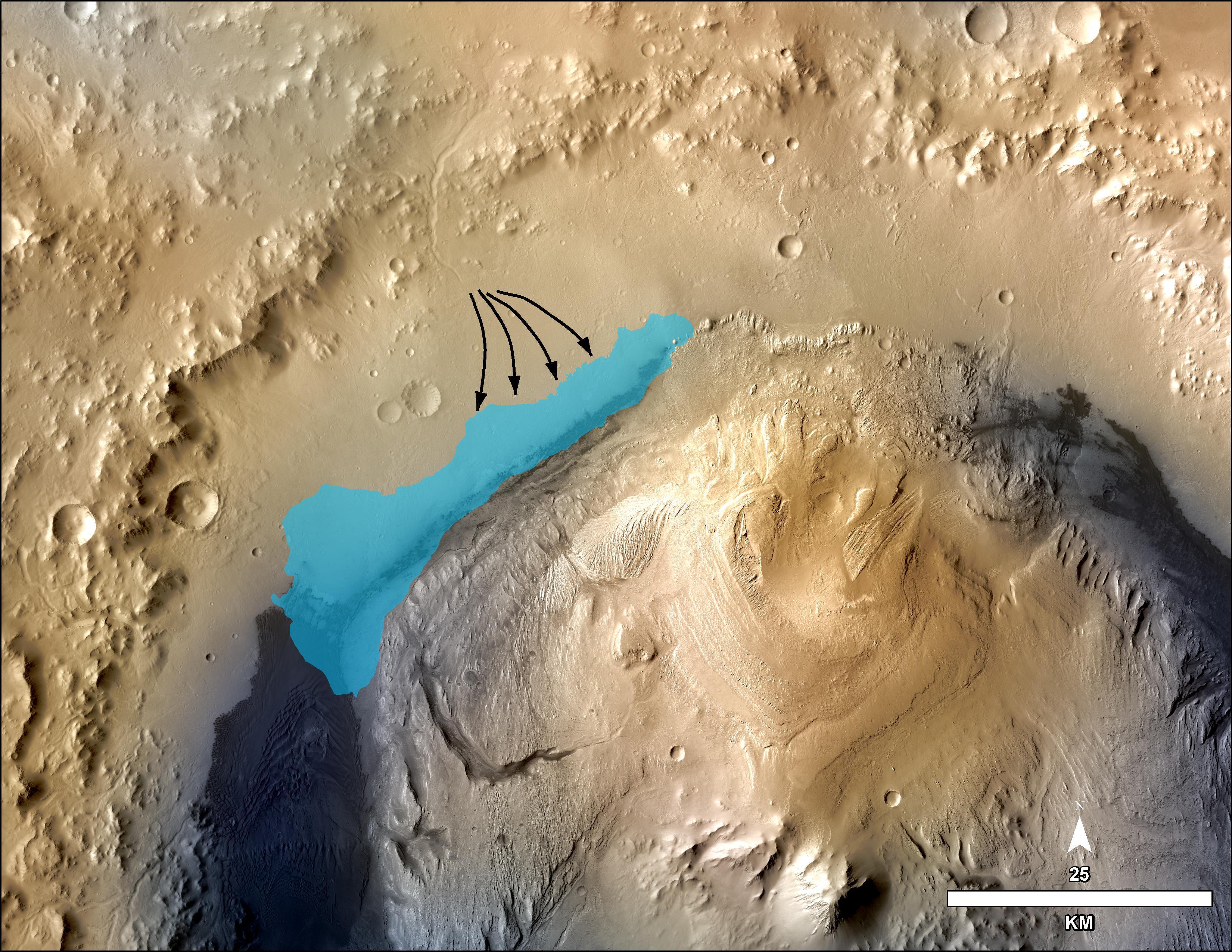
English: PIA17596: Possible Extent of Ancient Lake in Gale Crater, Mars
http://photojournal.jpl.nasa.gov/catalog/PIA17596 This illustration depicts a concept for the possible extent of an ancient lake inside Gale Crater. The existence of a lake there billions of years ago was confirmed from examination of mudstone in the crater's Yellowknife Bay area. For this illustration, the possible extent was estimated by mapping ancient lake and stream deposits and recognizing that water flowed from the crater rim into the basin (arrows). The water would have pooled in the linear depression created between the crater rim and Mt. Sharp. The area's history likely included the coming and going of multiple lakes of different sizes as climate conditions evolved. The base map combines image data from the Context Camera on NASA's Mars Reconnaissance Orbiter and color information from Viking Orbiter imagery. The 25-kilometer scale bar at lower right is 15.5 miles long. North is up. NASA's Jet Propulsion Laboratory, Pasadena, Calif., manages the Mars Science Laboratory Project and the mission's Curiosity rover for NASA's Science Mission Directorate in Washington. The rover was designed and assembled at JPL, a division of the California Institute of Technology in Pasadena. More information about Curiosity is online at http://www.nasa.gov/msl and http://mars.jpl.nasa.gov/msl/. |
| 日期 | |
| 来源 | http://photojournal.jpl.nasa.gov/jpeg/PIA17596.jpg |
| 作者 | NASA/JPL-Caltech/MSSS |
许可协议
| 本文件完全由NASA创作,在美国属于公有领域。根据NASA的版权方针,NASA的材料除非另有声明否则不受版权保护。(参见Template:PD-USGov/zh、NASA版权方针页面或JPL图片使用方针。) | ||
 |
警告:
|
文件历史
点击某个日期/时间查看对应时刻的文件。
| 日期/时间 | 缩略图 | 大小 | 用户 | 备注 | |
|---|---|---|---|---|---|
| 当前 | 2013年12月14日 (六) 15:48 | | 3,300 × 2,550(1.28 MB) | Drbogdan | User created page with UploadWizard |
文件用途
以下页面使用本文件:
全域文件用途
以下其他wiki使用此文件:
- en-two.iwiki.icu上的用途
- es.wikipedia.org上的用途
- it.wikipedia.org上的用途
- ja-two.iwiki.icu上的用途
- pnb.wikipedia.org上的用途
- uk.wikipedia.org上的用途
- ur.wikipedia.org上的用途