
File:PIA21256 - Color Variations on Mount Sharp, Mars (White Balanced), Figure 1.jpg

原始文件 (3,480 × 1,252像素,文件大小:2.98 MB,MIME类型:image/jpeg)
,_Figure_1.jpg?uselang=zh)
,_Figure_1.jpg?uselang=zh)
,_Figure_1.jpg?action=history&uselang=zh)
,_Figure_1.jpg)
摘要
| 描述 |
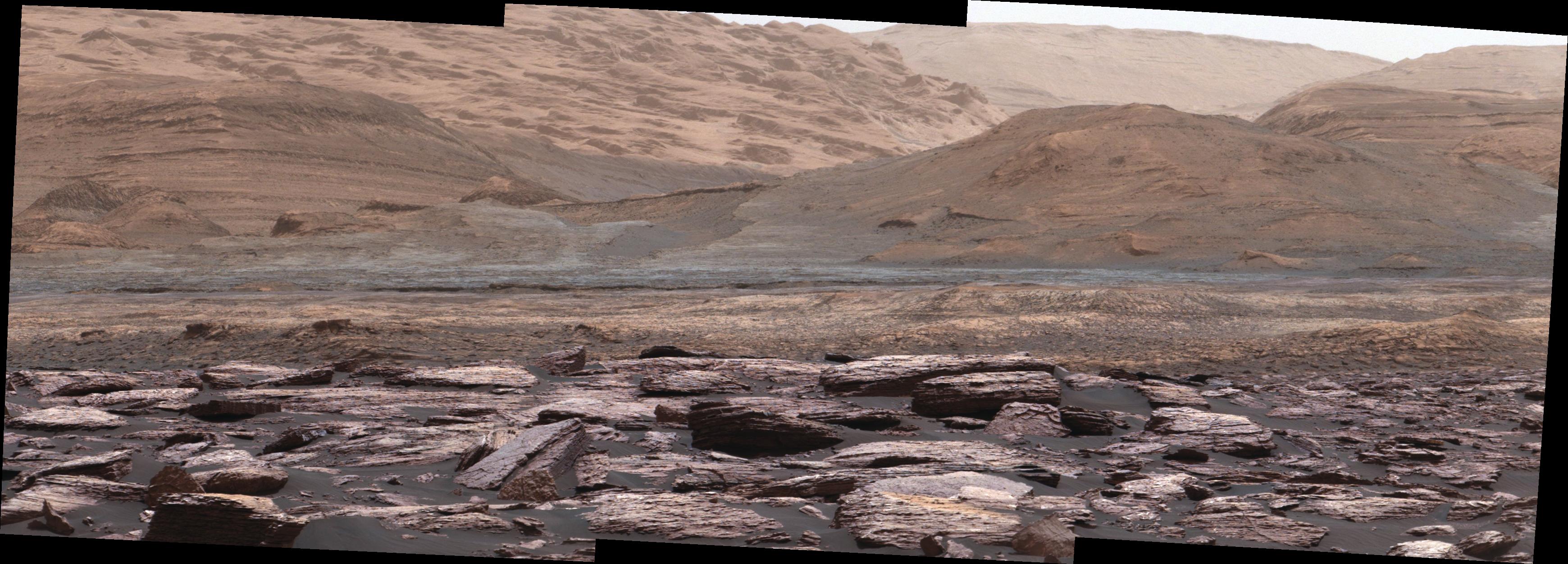
English: The foreground of this scene from the Mast Camera (Mastcam) on NASA's Curiosity Mars rover shows purple-hued rocks near the rover's late-2016 location on lower Mount Sharp. The scene's middle distance includes higher layers that are future destinations for the mission.
Variations in color of the rocks hint at the diversity of their composition on lower Mount Sharp. The purple tone of the foreground rocks has been seen in other rocks where Curiosity's Chemical and Mineralogy (CheMin) instrument has detected hematite. Winds and windblown sand in this part of Curiosity's traverse and in this season tend to keep rocks relatively free of dust, which otherwise can cloak rocks' color. The three frames combined into this mosaic were acquired by the Mastcam's right-eye camera on Nov. 10, 2016, during the 1,516th Martian day, or sol, of Curiosity's work on Mars. The scene is presented with a color adjustment that approximates white balancing, to resemble how the rocks and sand would appear under daytime lighting conditions on Earth. Sunlight on Mars is tinged by the dusty atmosphere and this adjustment helps geologists recognize color patterns they are familiar with on Earth. The view spans about 15 compass degrees, with the left edge toward southeast. The rover's planned direction of travel from its location when this scene was recorded is generally southeastward. The orange-looking rocks just above the purplish foreground ones are in the upper portion of the Murray formation, which is the basal section of Mount Sharp, extending up to a ridge-forming layer called the Hematite Unit. Beyond that is the Clay Unit, which is relatively flat and hard to see from this viewpoint. The next rounded hills are the Sulfate Unit, Curiosity's highest planned destination. The most distant slopes in the scene are higher levels of Mount Sharp, beyond where Curiosity will drive. Figure 1 is a version of the same scene with annotations added as reference points for distance, size and relative elevation. The annotations are triangles with text telling the distance (in kilometers) to the point in the image marked by the triangle, the point's elevation (in meters) relative to the rover's location, and the size (in meters) of an object as big as the triangle at that distance. Malin Space Science Systems, San Diego, built and operates Mastcam. NASA's Jet Propulsion Laboratory, a division of Caltech in Pasadena, manages the Mars Science Laboratory Project for NASA's Science Mission Directorate, Washington, and built the project's Curiosity rover. For more information about Curiosity, visit http://www.nasa.gov/msl and http://mars.jpl.nasa.gov/msl. |
| 日期 | 10 November 2016 (published 13 December 2016) |
| 来源 | Catalog page · Full-res (JPEG · TIFF) |
| 作者 | NASA/JPL-Caltech/MSSS |
| 火星上的位置 | 在以下服务上查看本图像和附近其他图像: Google地图 |
|---|
,_Figure_1.jpg¶ms=-04.706167_N_0137.356661_E_globe:Mars__&language=zh)
| 此标签不表示文件的著作权状态。任何文件在附有此标签的同時还需要一个有效的著作权标签。请参阅许可协议说明页面以了解更多信息。 其他语言:
|
| This media is a product of the Mars Science Laboratory mission Credit and attribution belongs to the mission team, if not already specified in the "author" row |
许可协议
| 本文件完全由NASA创作,在美国属于公有领域。根据NASA的版权方针,NASA的材料除非另有声明否则不受版权保护。(参见Template:PD-USGov/zh、NASA版权方针页面或JPL图片使用方针。) | ||
 |
警告:
|
文件历史
点击某个日期/时间查看对应时刻的文件。
| 日期/时间 | 缩略图 | 大小 | 用户 | 备注 | |
|---|---|---|---|---|---|
| 当前 | 2016年12月14日 (三) 22:29 | 3,480 × 1,252(2.98 MB) | Drbogdan | User created page with UploadWizard |
文件用途
以下页面使用本文件:
全域文件用途
以下其他wiki使用此文件:
- en-two.iwiki.icu上的用途
- en.wikiversity.org上的用途
- it.wikipedia.org上的用途
,_Figure_1.jpg)