
File:US map - rivers and lakes2.jpg
本预览的尺寸:800 × 540像素。 其他分辨率:320 × 216像素 | 640 × 432像素 | 1,024 × 691像素 | 1,476 × 996像素。
原始文件 (1,476 × 996像素,文件大小:559 KB,MIME类型:image/jpeg)
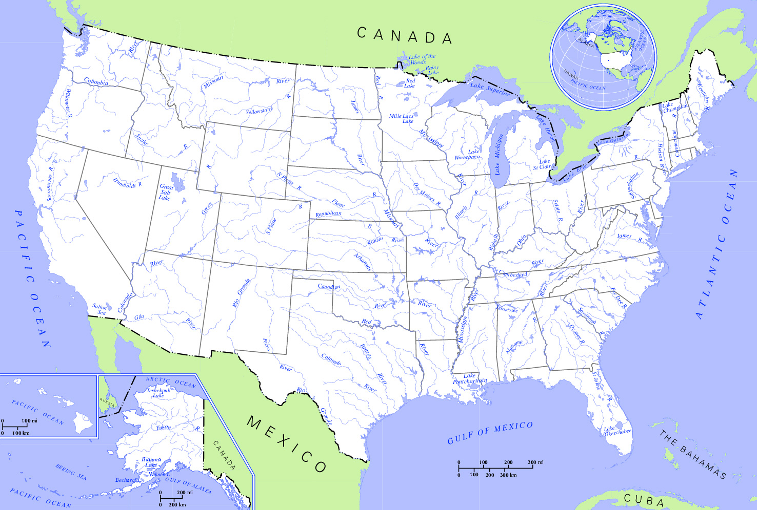
| 描述 | Rivers and Lakes in the United States. * Author: US Department of Interior * Source: http://nationalatlas.gov, there also available as PDF |
| 日期 | (UTC) |
| 来源 | |
| 作者 | US Department of Interior |
| 这是一张修改过的图片,这意味着它已在原版本的基础上通过软件进行了编辑,改动内容:Changed hue to increase contrast and cropped the map。其原始版本为:US map - rivers and lakes.png。修改者:Monfornot。
|
本地圖取自美國國家地圖集的某個版本。國家地圖集的絕大多數作品是美國聯邦政府的作品,因此屬於公有領域。
連結網址︰ NationalAtlas.gov | 1970年印刷版︰ 國會檔案館, Perry-Castañeda圖書館
|
原始上传日志
This image is a derivative work of the following images:
- File:US_map_-_rivers_and_lakes.png licensed with PD-USGov
- 2004-11-12T15:11:08Z Duesentrieb 1584x1224 (308269 Bytes) Rivers and lakes in the US; Dept. of Interior, Public Domain
Uploaded with derivativeFX
文件历史
点击某个日期/时间查看对应时刻的文件。
| 日期/时间 | 缩略图 | 大小 | 用户 | 备注 | |
|---|---|---|---|---|---|
| 当前 | 2009年1月2日 (五) 21:12 | | 1,476 × 996(559 KB) | Monfornot | {{Information |Description=Rivers and Lakes in the United States. * '''Author:''' US Department of Interior * '''Source:''' http://nationalatlas.gov, there also available as PDF |Source=*File:US_map_-_rivers_and_lakes.png |Date=2009-01-02 21:0 |
文件用途
没有页面链接到本图像。
全域文件用途
以下其他wiki使用此文件:
- az.wikipedia.org上的用途
- be.wikipedia.org上的用途
- bg.wikipedia.org上的用途
- en-two.iwiki.icu上的用途
- hy.wikipedia.org上的用途
- ru.wikipedia.org上的用途