
File:WKshatrapas.jpg
本预览的尺寸:467 × 600像素。 其他分辨率:187 × 240像素 | 374 × 480像素 | 598 × 768像素 | 1,121 × 1,440像素。
原始文件 (1,121 × 1,440像素,文件大小:309 KB,MIME类型:image/jpeg)
摘要
| 描述 |
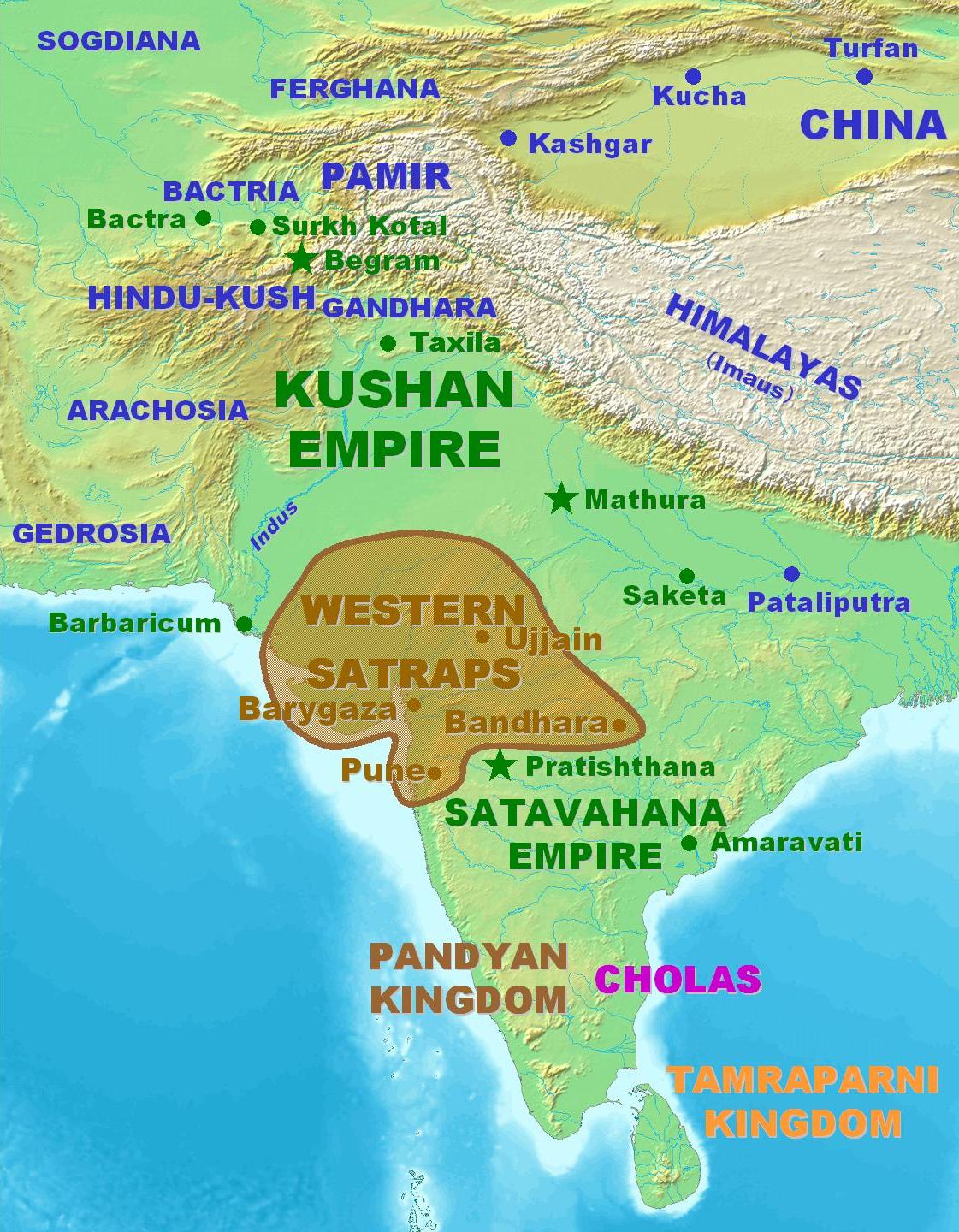
English: Territorial extent of the Western Kshatrapas. |
||
| 来源 |
|
||
| 作者 | User PHG at en-two.iwiki.icu | ||
| 授权 (二次使用本文件) |
Personal map. Released in the Public Domain. |

许可协议
| 本作品已被作者PHG释出到公有领域。这适用于全世界。 在一些国家这可能不合法;如果是这样的话,那么: |
文件历史
点击某个日期/时间查看对应时刻的文件。
| 日期/时间 | 缩略图 | 大小 | 用户 | 备注 | |
|---|---|---|---|---|---|
| 当前 | 2007年3月4日 (日) 11:33 | | 1,121 × 1,440(309 KB) | World Imaging | Better map |
| 2007年2月5日 (一) 19:32 |  | 1,122 × 1,440(313 KB) | World Imaging | Better image. | |
| 2007年2月4日 (日) 20:58 |  | 1,127 × 1,440(316 KB) | World Imaging | Better map. | |
| 2007年2月4日 (日) 15:28 |  | 1,124 × 1,440(315 KB) | World Imaging | Better map. Own work. | |
| 2006年12月13日 (三) 23:25 |  | 462 × 504(37 KB) | Electionworld | {{ew|en|PHG}} Territorial extent of the Western Kshatrapas. Personal map. Released in the Public Domain. {{pd-user|PHG}} |
文件用途
以下页面使用本文件:
全域文件用途
以下其他wiki使用此文件:
- azb.wikipedia.org上的用途
- ba.wikipedia.org上的用途
- bn.wikipedia.org上的用途
- cs.wikipedia.org上的用途
- en-two.iwiki.icu上的用途
- es.wikipedia.org上的用途
- fa.wikipedia.org上的用途
- fa.wikibooks.org上的用途
- fr.wikipedia.org上的用途
- hi.wikipedia.org上的用途
- hu.wikipedia.org上的用途
- hy.wikipedia.org上的用途
- it.wikipedia.org上的用途
- ja-two.iwiki.icu上的用途
- ka.wikipedia.org上的用途
- lt.wikipedia.org上的用途
- ml.wikipedia.org上的用途
- nl.wikipedia.org上的用途
- ru.wikipedia.org上的用途
- sh.wikipedia.org上的用途
- sq.wikipedia.org上的用途
- ta.wikipedia.org上的用途
- tt.wikipedia.org上的用途
- uk.wikipedia.org上的用途
- vi.wikipedia.org上的用途
- www.wikidata.org上的用途