
File:Wellington landsat labelled.jpg
本预览的尺寸:800 × 593像素。 其他分辨率:320 × 237像素 | 640 × 474像素 | 1,024 × 758像素 | 1,280 × 948像素。
原始文件 (1,280 × 948像素,文件大小:206 KB,MIME类型:image/jpeg)
| 描述 |
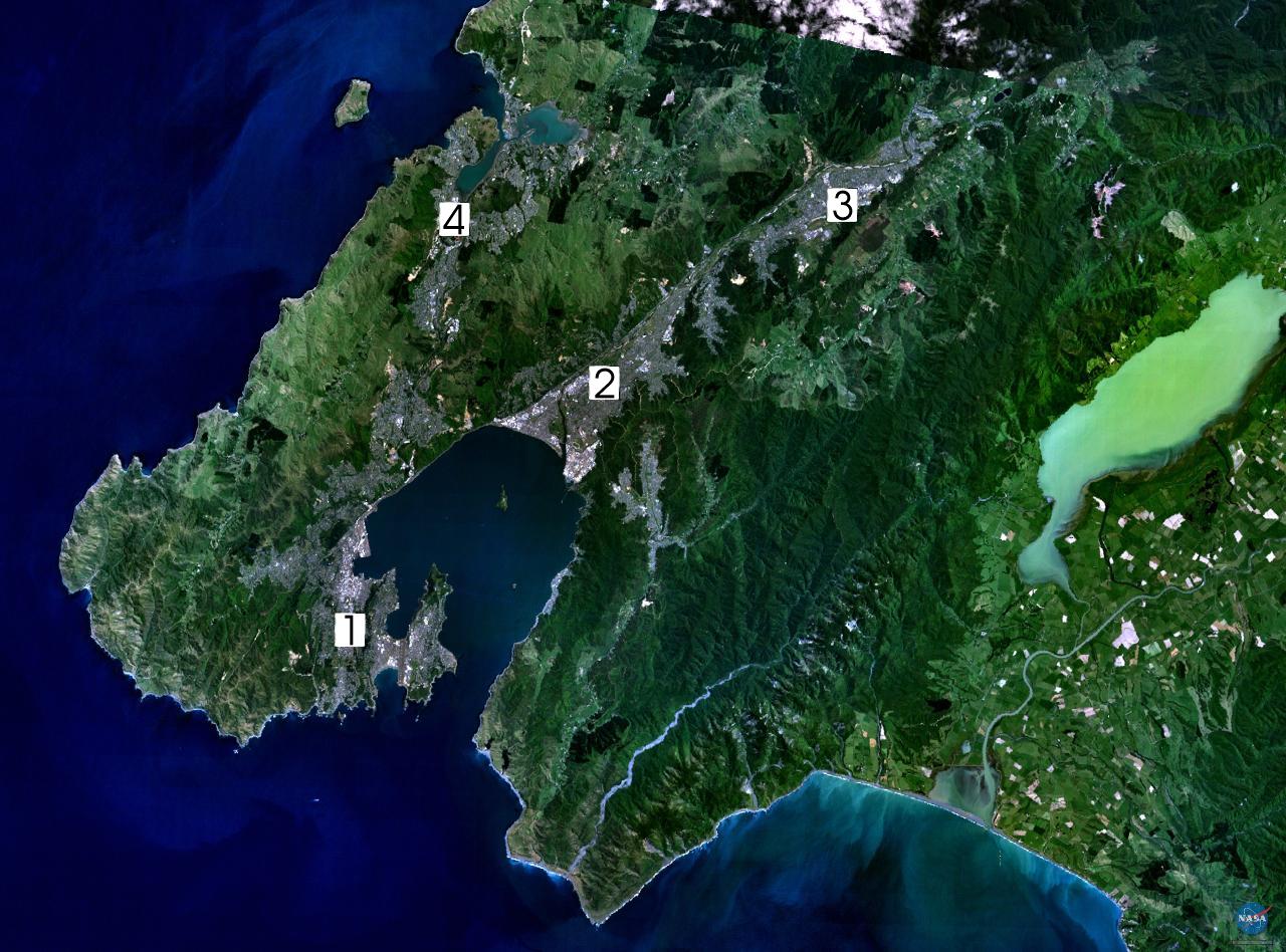
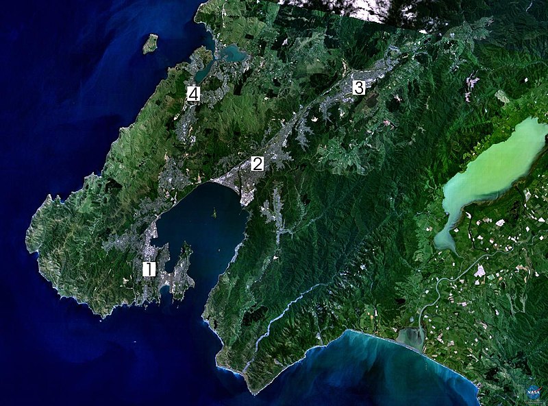
NASA World Wind composite landsat-7 satellite image of Wellington, New Zealand. (1) Central Wellington (2) Lower Hutt (3) Upper Hutt (4) Porirua. English: Satellite photo of the Wellington conurbation: (1) Wellington; (2) Lower Hutt; (3) Upper Hutt; (4) Porirua.
日本語: 人工衛星によるウェリントンの写真。1: ウェリントン、2: ロウワー・ハット (Lower Hutt)、3: アッパー・ハット (Upper Hutt)、4: ポリルア (Porirua)。以上の4市がウェリントン都市圏 (urban area) を構成する
Norsk bokmål: Satelittfoto av Wellingtonregionen. (1) Wellington (2) Lower Hutt (3) Upper Hutt (4) Porirua |
|||
| 来源 | en:wikipedia | |||
| 作者 | NASA, edited by en:User:Clawed | |||
| 授权 (二次使用本文件) |
|

文件历史
点击某个日期/时间查看对应时刻的文件。
| 日期/时间 | 缩略图 | 大小 | 用户 | 备注 | |
|---|---|---|---|---|---|
| 当前 | 2005年9月1日 (四) 16:34 | | 1,280 × 948(206 KB) | Klipp~commonswiki | NASA World Wind composite landsat-7 satellite image of Wellington, New Zealand. (1) Central Wellington (2) Lower Hutt (3) Upper Hutt (4) Porirua. {{PD-USGov-NASA}} |
文件用途
以下页面使用本文件:
全域文件用途
以下其他wiki使用此文件:
- ast.wikipedia.org上的用途
- ca.wikipedia.org上的用途
- da.wikipedia.org上的用途
- de.wikipedia.org上的用途
- el.wikipedia.org上的用途
- en-two.iwiki.icu上的用途
- Wellington Region
- Hutt Valley
- Lake Wairarapa
- Category:Wikipedians in New Zealand
- User:Ollieinc/Userboxes
- User:Ollieinc/Userboxes/Wider Wellington
- User:Ollieinc/Userboxes/hasWider Wellington
- Wikipedia:Wikipedians in New Zealand user boxes
- Wikipedia:Userboxes/Location/New Zealand
- User:Joseph Pelorus
- User:CatholicKiwi
- User:WG at Dole
- eo.wikipedia.org上的用途
- es.wikipedia.org上的用途
- fr.wikipedia.org上的用途
- gl.wikipedia.org上的用途
- hu.wikipedia.org上的用途
- ja-two.iwiki.icu上的用途
- mi.wikipedia.org上的用途
- nn.wikipedia.org上的用途
- no.wikipedia.org上的用途
- pl.wikipedia.org上的用途
- pt.wikipedia.org上的用途
- sv.wikipedia.org上的用途
- tr.wikipedia.org上的用途
- uk.wikipedia.org上的用途
- www.wikidata.org上的用途