
File:Map of Gosport, 1757.jpg
原始檔案 (4,000 × 1,918 像素,檔案大小:981 KB,MIME 類型:image/jpeg)
摘要
| 描述 |
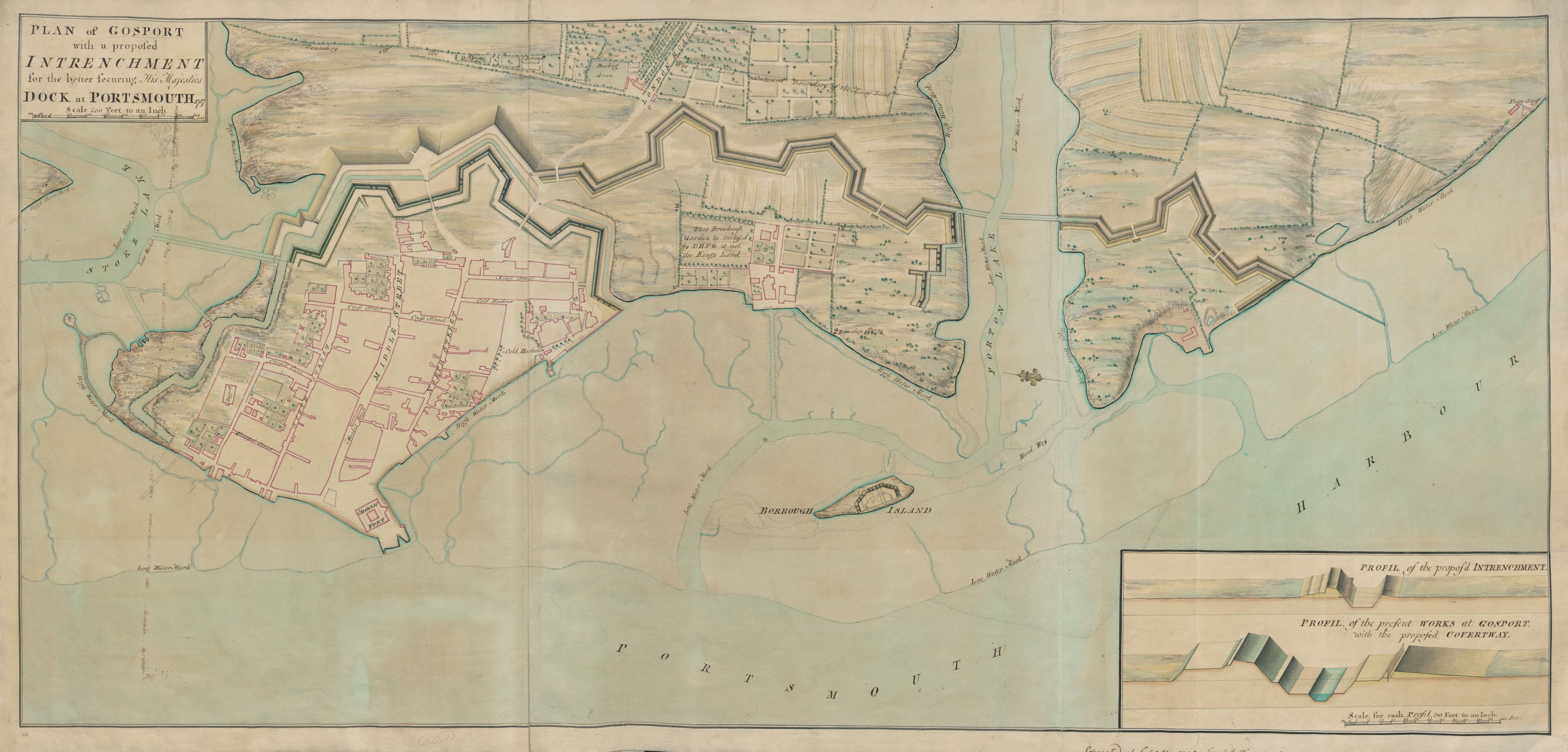
English: Map information:
Title: "Plan of Gosport ;" Author(s): Desmaretz, J. P. British Library shelfmark: Maps K.Top.14.24. Place of publication: [Portsmouth] Publisher: [Desmaretz]., Date of publication: [1757 c.] Item type: 1 map Medium: pen and ink with handcolouring Dimensions: 48.9 x 106.8 cm Former owner: George III, King of Great Britain, 1738-1820 - Explore this item in the British Library’s catalogue - View all the illustrations found in this publication - Order a higher quality scanned version of this image from the British Library (maps_k_top_14_24) The Topographical Collection of George III contains drawn and printed maps, views and atlases produced between 1500 and 1824. Read more about the collection here. Explore and experiment with the British Library’s digital collections. The British Library community is able to flourish online thanks to freely available resources such as this. You can help support our mission to continue making our collection accessible to everyone, for research, inspiration and enjoyment, by donating on the British Library supporter webpage here. Thank you for supporting the British Library. |
| 日期 | |
| 來源 | https://www.flickr.com/photos/britishlibrary/50265603632/ |
| 作者 | British Library |
授權條款
This image was taken from Flickr's The Commons. The uploading organization may have various reasons for determining that no known copyright restrictions exist, such as:
More information can be found at https://flickr.com/commons/usage/. Please add additional copyright tags to this image if more specific information about copyright status can be determined. See Commons:Licensing for more information. |
| 這幅圖片原始出處為Flickr的https://flickr.com/photos/12403504@N02/50265603632 ,作者為The British Library 。經機器人FlickreviewR 2在2021年6月21日審查後確定為採用No known copyright restrictions的協議授權使用。 |
檔案歷史
點選日期/時間以檢視該時間的檔案版本。
| 日期/時間 | 縮圖 | 尺寸 | 使用者 | 備註 | |
|---|---|---|---|---|---|
| 目前 | 2021年6月21日 (一) 16:18 | | 4,000 × 1,918(981 KB) | Barabbas1312 | Uploaded a work by British Library from https://www.flickr.com/photos/britishlibrary/50265603632/ with UploadWizard |
檔案用途
下列頁面有用到此檔案:
全域檔案使用狀況
以下其他 wiki 使用了這個檔案:
- en-two.iwiki.icu 的使用狀況