
File:Ritter Range Pacific Crest Trail.jpg
預覽大小:450 × 600 像素。 其他解析度:180 × 240 像素 | 360 × 480 像素 | 576 × 768 像素 | 768 × 1,024 像素 | 1,424 × 1,898 像素。
原始檔案 (1,424 × 1,898 像素,檔案大小:2.8 MB,MIME 類型:image/jpeg)
摘要
| 描述 |
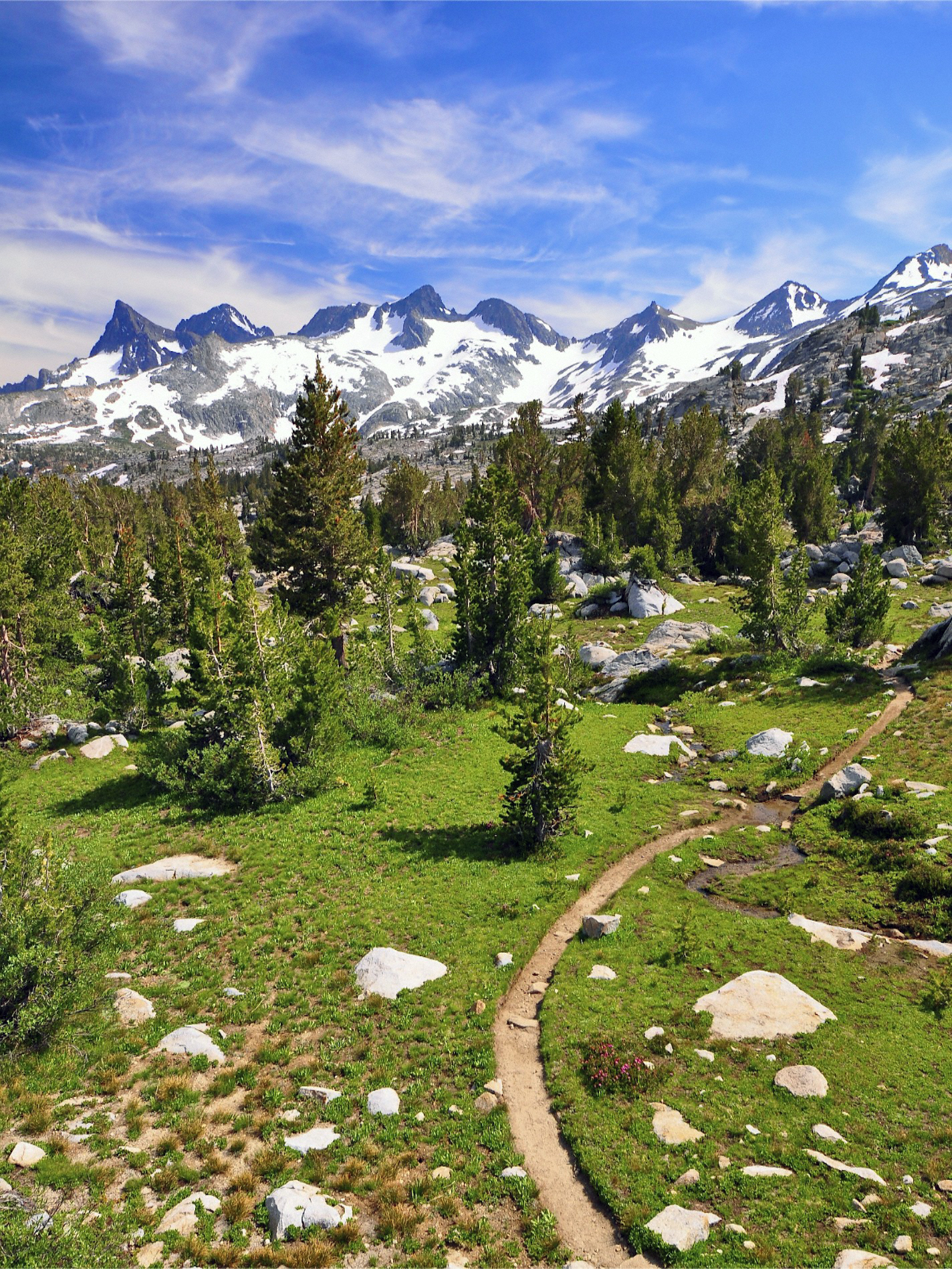
English: The Ritter Range run down the spine of Ansel Adams Wilderness from Yosemite's Mount Lyell to the Minarets west of Mammoth. This photograph was taken between Rush Creek and Donahue Pass. I found a big boulder I could stand on, and shot this vertical - the Pacific Crest Trail meandering through the scene. |
| 日期 | 攝於2011年8月12日, 15:33 |
| 來源 | Ritter Range, Ansel Adams Wilderness |
| 作者 | Steve Dunleavy from Lake Tahoe, NV, United States |
授權條款
此檔案採用創用CC 姓名標示 2.0 通用版授權條款。
- 您可以自由:
- 分享 – 複製、發佈和傳播本作品
- 重新修改 – 創作演繹作品
- 惟需遵照下列條件:
- 姓名標示 – 您必須指名出正確的製作者,和提供授權條款的連結,以及表示是否有對內容上做出變更。您可以用任何合理的方式來行動,但不得以任何方式表明授權條款是對您許可或是由您所使用。
| This image, originally posted to Flickr, was reviewed on 21 October 2012 by the administrator or reviewer File Upload Bot (Magnus Manske), who confirmed that it was available on Flickr under the stated license on that date. |
檔案歷史
點選日期/時間以檢視該時間的檔案版本。
| 日期/時間 | 縮圖 | 尺寸 | 使用者 | 備註 | |
|---|---|---|---|---|---|
| 目前 | 2012年10月21日 (日) 23:45 | | 1,424 × 1,898(2.8 MB) | File Upload Bot (Magnus Manske) | Transferred from Flickr by User:Hike395 using flickr2commons |
檔案用途
下列3個頁面有用到此檔案:
全域檔案使用狀況
以下其他 wiki 使用了這個檔案:
- ar.wikipedia.org 的使用狀況
- bg.wikipedia.org 的使用狀況
- cs.wikipedia.org 的使用狀況
- de.wikipedia.org 的使用狀況
- en-two.iwiki.icu 的使用狀況
- Pacific Crest Trail
- John Muir Trail
- Mist Trail
- American Discovery Trail
- Skyline-to-the-Sea Trail
- Bay Area Ridge Trail
- Iron Horse Regional Trail
- Tahoe Rim Trail
- Los Gatos Creek Trail
- Hetch Hetchy to Lake Vernon Trail
- Juan Bautista de Anza National Historic Trail
- San Francisco Bay Trail
- Santa Clara River Trail
- Sam Merrill Trail
- Ohlone Greenway
- Silver Moccasin Trail
- Mount Wilson Toll Road
- High Sierra Trail
- Windy Gap Trail (Angeles National Forest)
- Jedediah Smith Memorial Trail
- Sawyer Camp Trail
- Gabrielino Trail
- Sonoma Coast State Park
- Santa Rosa Creek
- Sierra High Route
- Contra Costa Canal
- Four Mile Trail
- Richmond Greenway
- MacKerricher State Park
- Spur Trail
- Mount Whitney Trail
- Backbone Trail
- Pine Ridge Trail
- Long Meadow Grove
- Barbary Coast Trail
- Bigfoot Trail
- California Coastal Trail
- Nobles Emigrant Trail
- John W. Christian Greenbelt
- Silver Knapsack Trail
- Brad Freeman Trail
- Cactus to Clouds Trail
- Great Western Loop
- Pinnacle and Shorttail Gulch Coastal Access Trails
- Joe Rodota Trail
- Philosopher's Way, San Francisco
檢視此檔案的更多全域使用狀況。