
File:Satellite Loop of Hurricane Iota 11-16-2020.gif
預覽大小:600 × 600 像素。 其他解析度:240 × 240 像素 | 480 × 480 像素 | 1,000 × 1,000 像素。
原始檔案 (1,000 × 1,000 像素,檔案大小:20.34 MB,MIME 類型:image/gif、循環、50 畫格、4.9秒)
摘要
| 描述 |
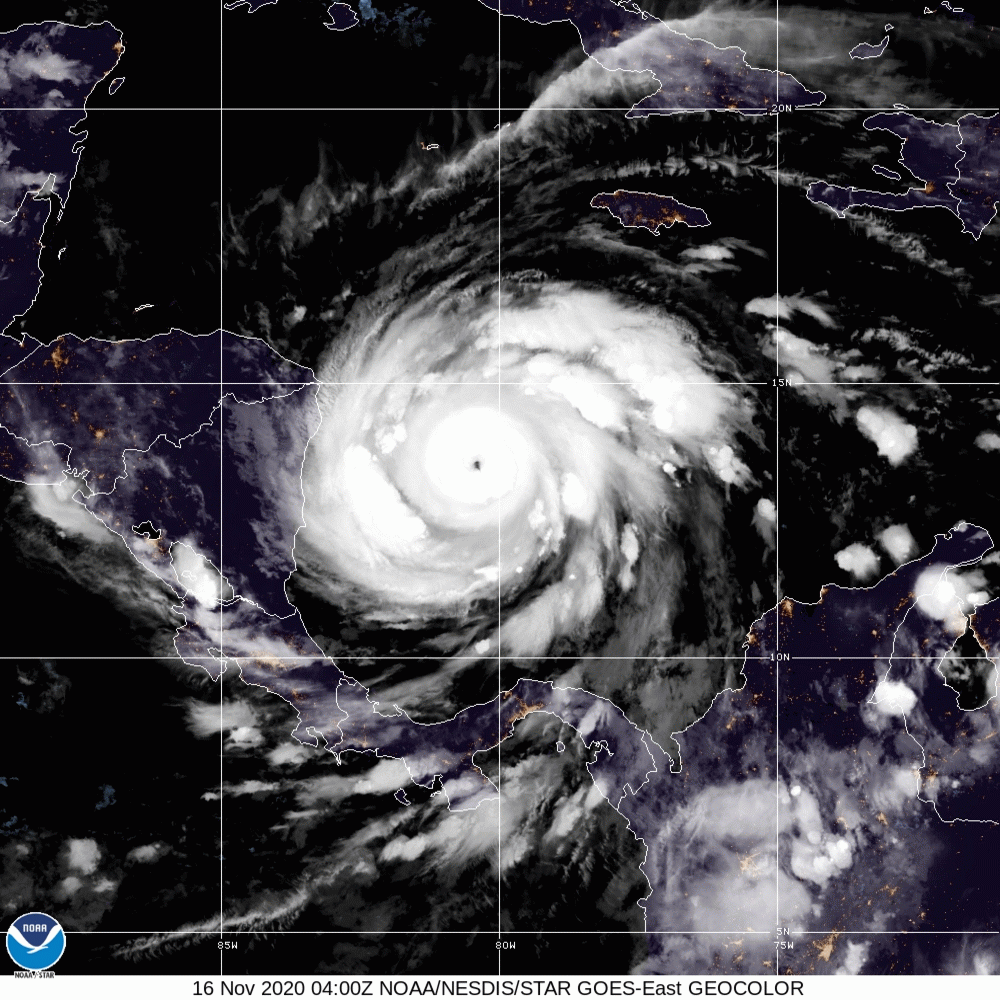
English: This satellite loop was taken early on Monday November 16, 2020 and it shows Hurricane Iota continue to rapidly intensify the storm's intensity at the time of the end of the satellite loop was (155 mph; 925 millibars) later that day Iota's pressure would drop another 8 millibars.
(Spanish:Este circuito satelital se tomó temprano el lunes 16 de noviembre de 2020 y muestra que el huracán Iota continúa intensificando rápidamente la intensidad de la tormenta en el momento en que el final del circuito satelital fue (155 mph; 925 milibares) más tarde ese día, la presión de Iota caería otro 8 milibares.) |
| 日期 | |
| 來源 | https://www.star.nesdis.noaa.gov |
| 作者 | NOAA |
授權條款
本圖像屬於公有領域,因該作品最初來自於美國國家海洋和大氣管理局職員的職務作品。
|
檔案歷史
點選日期/時間以檢視該時間的檔案版本。
| 日期/時間 | 縮圖 | 尺寸 | 使用者 | 備註 | |
|---|---|---|---|---|---|
| 目前 | 2020年11月16日 (一) 13:04 | | 1,000 × 1,000(20.34 MB) | TheWxResearcher | Uploaded a work by NOAA from https://www.star.nesdis.noaa.gov with UploadWizard |
檔案用途
下列2個頁面有用到此檔案:
全域檔案使用狀況
以下其他 wiki 使用了這個檔案:
- ca.wikipedia.org 的使用狀況
- en-two.iwiki.icu 的使用狀況
- kw.wikipedia.org 的使用狀況
- nl.wikipedia.org 的使用狀況
- pt.wikipedia.org 的使用狀況
- simple.wikipedia.org 的使用狀況
- vi.wikipedia.org 的使用狀況