
File:US federal land.agencies.svg

此 SVG 檔案的 PNG 預覽的大小:776 × 600 像素。 其他解析度:311 × 240 像素 | 621 × 480 像素 | 994 × 768 像素 | 1,280 × 989 像素 | 2,560 × 1,978 像素 | 990 × 765 像素。
原始檔案 (SVG 檔案,表面大小:990 × 765 像素,檔案大小:3.65 MB)
Department of Defense (includes Army Corps of Engineers projects)
Other agencies
摘要
| 描寫 |
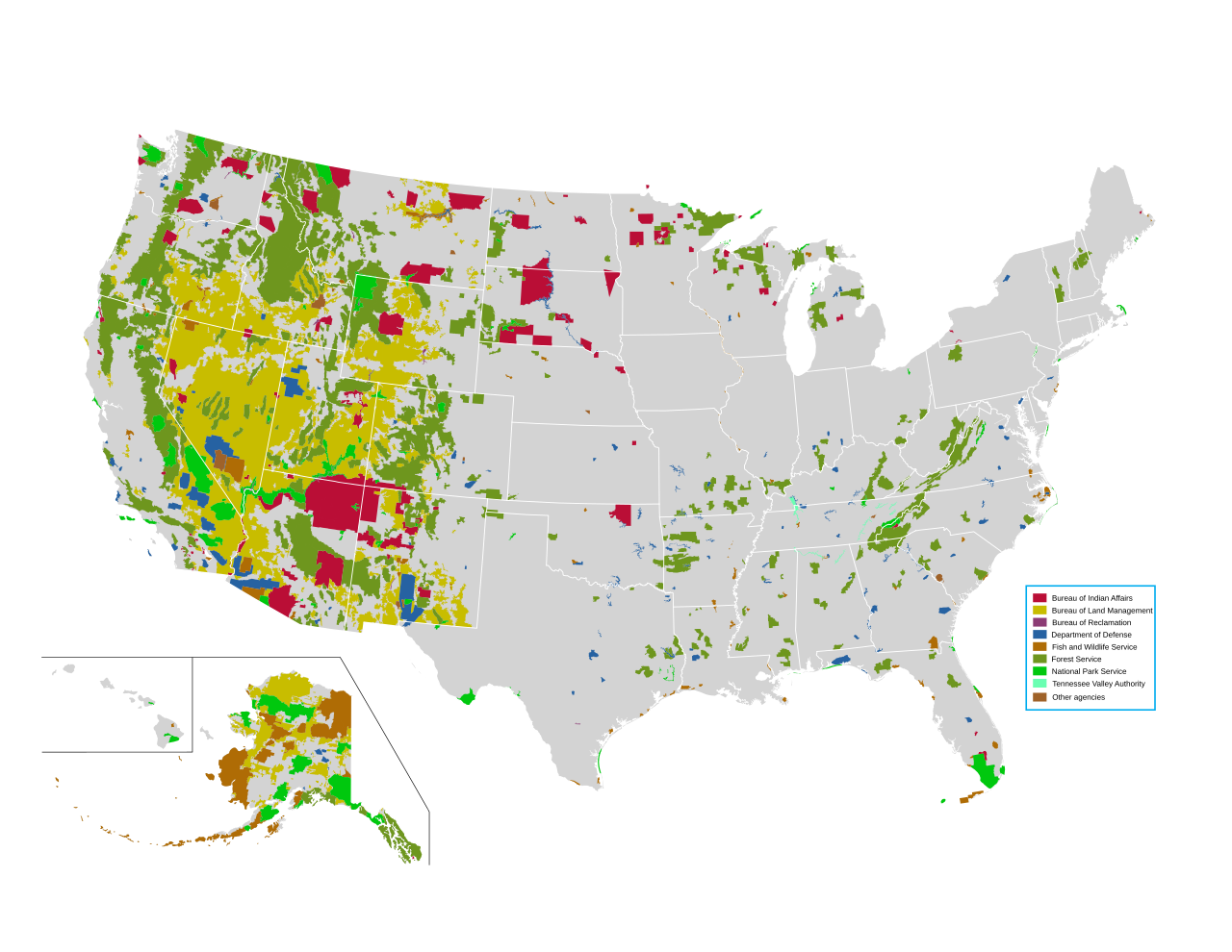
English: Map of all federally owned land in the United States. |
| Geotemporal data | |
| 描繪日期 | |
| 地圖位置 | United States |
| 地圖類型 | thematic map |
| 空間參照系統 | Albers |
| 地理參考 | 如果不合適,請設定「warp_status = skip」為隱藏。 |
| 描述 |
English: Map of all federally owned land in the United States. |
| 來源 | http://nationalatlas.gov/printable/fedlands.html, "All Federal and Indian Lands" |
| 作者 | National Atlas of the United States |
授權條款
本地圖取自美國國家地圖集的某個版本。國家地圖集的絕大多數作品是美國聯邦政府的作品,因此屬於公有領域。
連結網址︰ NationalAtlas.gov | 1970年印刷版︰ 國會檔案館, Perry-Castañeda圖書館
|
檔案歷史
點選日期/時間以檢視該時間的檔案版本。
| 日期/時間 | 縮圖 | 尺寸 | 使用者 | 備註 | |
|---|---|---|---|---|---|
| 目前 | 2014年4月14日 (一) 22:42 | | 990 × 765(3.65 MB) | Interiot~commonswiki | fix text alignment |
| 2014年4月14日 (一) 22:34 |  | 990 × 765(3.65 MB) | Interiot~commonswiki | fix text alignment | |
| 2014年4月14日 (一) 22:27 |  | 990 × 765(3.65 MB) | Interiot~commonswiki |
檔案用途
下列2個頁面有用到此檔案:
全域檔案使用狀況
以下其他 wiki 使用了這個檔案:
- en-two.iwiki.icu 的使用狀況
- United States Forest Service
- Bureau of Land Management
- Public land
- Public domain (land)
- Sagebrush Rebellion
- Federal lands
- User:Kazkaskazkasako/Books/History
- Bundy standoff
- Grazing rights in Nevada
- Wikipedia:Reference desk/Archives/Humanities/2015 June 15
- Public lands in the United States
- Administrative state
- Environmental history of the United States
- en.wikivoyage.org 的使用狀況
- fr.wikipedia.org 的使用狀況
- he.wikipedia.org 的使用狀況
- it.wikipedia.org 的使用狀況
- pt.wikipedia.org 的使用狀況
- ru.wikipedia.org 的使用狀況
- sv.wikipedia.org 的使用狀況