
File:ESP-032436-1755-MarsCuriosityRover-MRO-HiRISE-20130627.jpg

預覽大小:800 × 500 像素。 其他解析度:320 × 200 像素 | 640 × 400 像素 | 1,024 × 640 像素 | 1,280 × 800 像素 | 2,880 × 1,800 像素。
原始檔案 (2,880 × 1,800 像素,檔案大小:5.42 MB,MIME 類型:image/jpeg)
摘要
| 描述 |
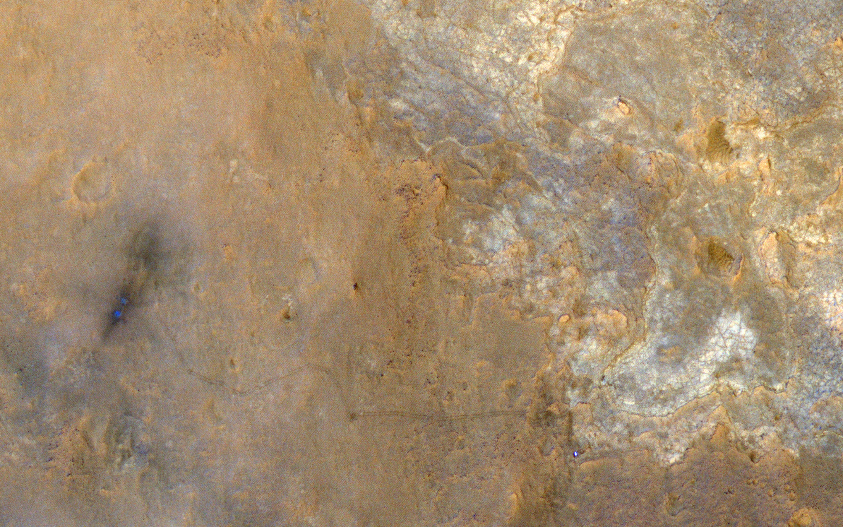
English: A Unique View of Curiosity Rover in Yellowknife Bay - This image was acquired with a large spacecraft roll to the east when the subsolar latitude was -7.26 degrees, close to the latitude of MSL (-4.6 degrees), resulting in an image with the sun, the MRO spacecraft, and the MSL Curiosity rover on the surface all aligned in nearly a straight line (phase angle of just 5.47 degrees).
This geometry hides shadows and better reveals subtle color variations. With enhanced colors, we can view the region around the landing site and Yellowknife Bay. The rover is the very bright spot near the lower right. The rover tracks stand out clearly in this view, extending west to the landing site where two bright, relatively blue spots indicate where MSL's landing jets cleared off the redder surface dust. The rover is now driving south towards the large mound in Gale Crater officially named Aeolis Mons and also called "Mount Sharp." |
| 日期 | |
| 來源 | http://www.uahirise.org/ESP_032436_1755 / http://www.uahirise.org/images/wallpaper/2880/ESP_032436_1755.jpg |
| 作者 | NASA/JPL-Caltech/Univ. of Arizona |
本圖像或影音收錄於美國國家航空暨太空總署 (NASA)噴射推進實驗室(Jet Propulsion Laboratory),其照片編號為: PIA17080 以及Alternate ID: ESP_032436_1755 此標籤不表示文件的著作權狀態。任何文件在附有此標籤的同時還需要一個有效的著作權標籤。請參閱許可協議說明頁面以了解更多資訊。 其他語言:
|
授權條款
| 本作品由NASA創作,屬於公有領域。根據NASA的版權政策:“NASA的創作除非另有聲明否則不受版權保護。”(參見:Template:PD-USGov/zh,NASA版權政策或JPL圖像使用政策) | ||
 |
警告:
|
檔案歷史
點選日期/時間以檢視該時間的檔案版本。
| 日期/時間 | 縮圖 | 尺寸 | 用戶 | 備註 | |
|---|---|---|---|---|---|
| 目前 | 2013年7月24日 (三) 19:56 | | 2,880 × 1,800(5.42 MB) | Drbogdan | User created page with UploadWizard |
檔案用途
下列頁面有用到此檔案:
全域檔案使用狀況
以下其他 wiki 使用了這個檔案:
- en-two.iwiki.icu 的使用狀況
- et.wikipedia.org 的使用狀況
- uk.wikipedia.org 的使用狀況