
File:Greece in 1210.svg

此 SVG 檔案的 PNG 預覽的大小:800 × 456 像素。 其他解析度:320 × 182 像素 | 640 × 365 像素 | 1,024 × 584 像素 | 1,280 × 730 像素 | 2,560 × 1,460 像素 | 3,508 × 2,000 像素。
原始檔案 (SVG 檔案,表面大小:3,508 × 2,000 像素,檔案大小:1.12 MB)
摘要
| 描述 |
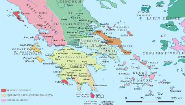
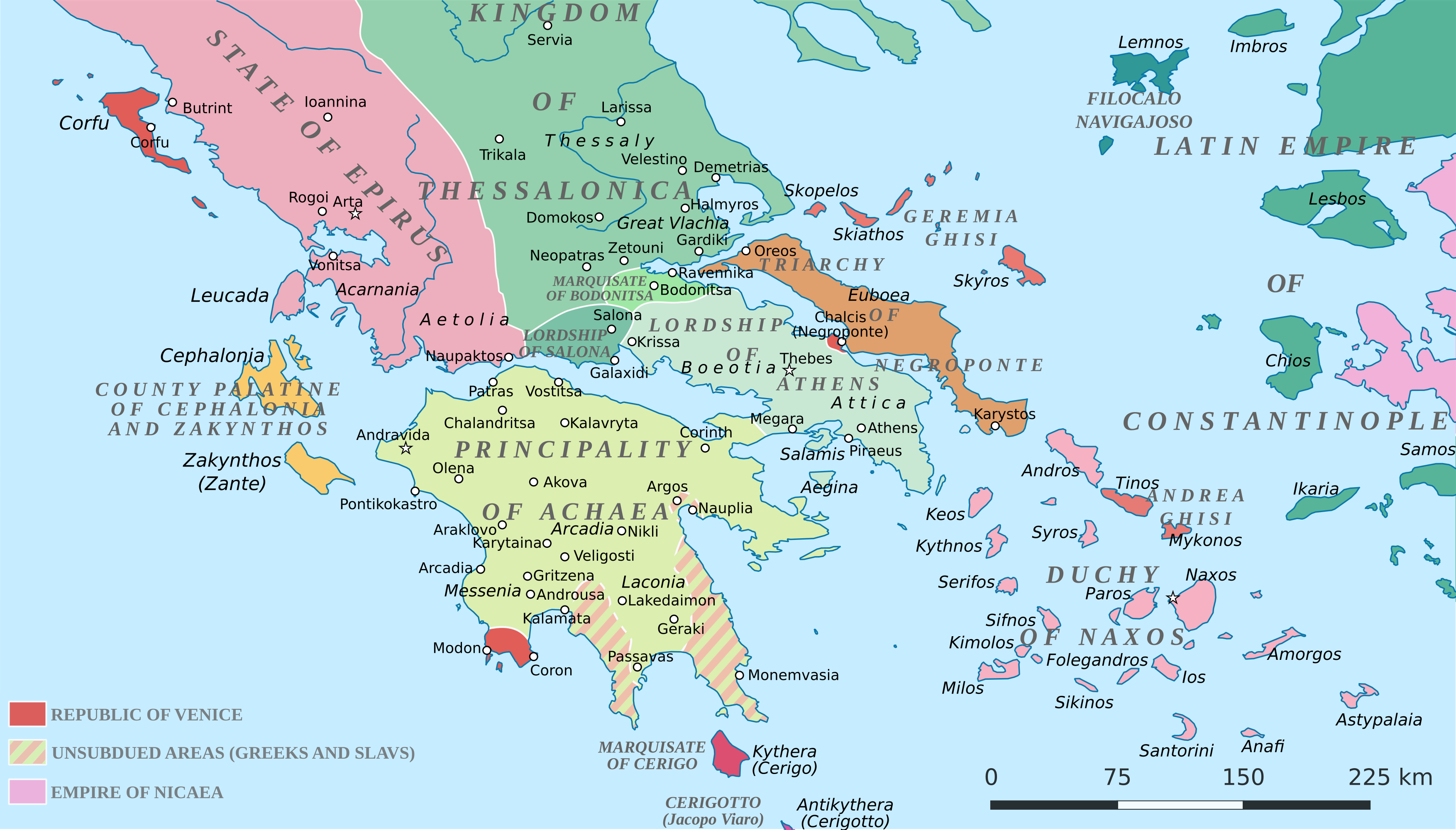
English: Political map of southern Greece in c. 1210, after the establishment of the Crusader states following the Fourth Crusade. |
| 日期 | |
| 來源 |
SVG base from File:Greece in 1210V1.svg; based on the original political map by William Miller (1908), with changes and corrections to account for newer scholarship:
|
| 作者 | Cplakidas |
| 其他版本 |
|


授權條款
我,本作品的著作權持有者,決定用以下授權條款發佈本作品:
此檔案採用共享創意 姓名標示-相同方式分享 4.0 國際授權條款。
- 您可以自由:
- 分享 – 複製、發佈和傳播本作品
- 重新修改 – 創作演繹作品
- 惟需遵照下列條件:
- 姓名標示 – 您必須指名出正確的製作者,和提供授權條款的連結,以及表示是否有對內容上做出變更。您可以用任何合理的方式來行動,但不得以任何方式表明授權條款是對您許可或是由您所使用。
- 相同方式分享 – 如果您利用本素材進行再混合、轉換或創作,您必須基於如同原先的相同或兼容的條款,來分布您的貢獻成品。
檔案歷史
點選日期/時間以檢視該時間的檔案版本。
| 日期/時間 | 縮圖 | 尺寸 | 用戶 | 備註 | |
|---|---|---|---|---|---|
| 目前 | 2017年6月23日 (五) 19:59 | | 3,508 × 2,000(1.12 MB) | Cplakidas | fixed three names to paths |
| 2017年4月11日 (二) 12:08 |  | 3,508 × 2,000(1.1 MB) | Cplakidas | colour changes | |
| 2017年4月11日 (二) 11:48 |  | 3,508 × 2,000(1.11 MB) | Cplakidas | tweak around Coron | |
| 2017年2月11日 (六) 10:39 |  | 3,508 × 2,000(1.11 MB) | Cplakidas | tweaks in Negroponte, unsubdued areas | |
| 2017年2月8日 (三) 17:57 |  | 3,508 × 2,000(1.11 MB) | Cplakidas | tweaking the Morea | |
| 2017年2月8日 (三) 13:40 |  | 3,508 × 2,000(1.11 MB) | Cplakidas | slight tweaks | |
| 2017年2月8日 (三) 13:14 |  | 3,508 × 2,000(1.11 MB) | Cplakidas | User created page with UploadWizard |
檔案用途
全域檔案使用狀況
以下其他 wiki 使用了這個檔案:
- ar.wikipedia.org 的使用狀況
- az.wikipedia.org 的使用狀況
- bg.wikipedia.org 的使用狀況
- ca.wikipedia.org 的使用狀況
- da.wikipedia.org 的使用狀況
- de.wikipedia.org 的使用狀況
- el.wikipedia.org 的使用狀況
- en-two.iwiki.icu 的使用狀況
- eo.wikipedia.org 的使用狀況
- eu.wikipedia.org 的使用狀況
- fa.wikipedia.org 的使用狀況
- fr.wikipedia.org 的使用狀況
- gl.wikipedia.org 的使用狀況
- hr.wikipedia.org 的使用狀況
- id.wikipedia.org 的使用狀況
- it.wikipedia.org 的使用狀況
- ja-two.iwiki.icu 的使用狀況
- ko.wikipedia.org 的使用狀況
- ro.wikipedia.org 的使用狀況
- ru.wikipedia.org 的使用狀況
- sk.wikipedia.org 的使用狀況
檢視此檔案的更多全域使用狀況。