
File:North Country Trail Locator Map US.svg

此 SVG 檔案的 PNG 預覽的大小:800 × 417 像素。 其他解析度:320 × 167 像素 | 640 × 333 像素 | 1,024 × 533 像素 | 1,280 × 667 像素 | 2,560 × 1,333 像素 | 1,859 × 968 像素。
原始檔案 (SVG 檔案,表面大小:1,859 × 968 像素,檔案大小:691 KB)
| 描述 |
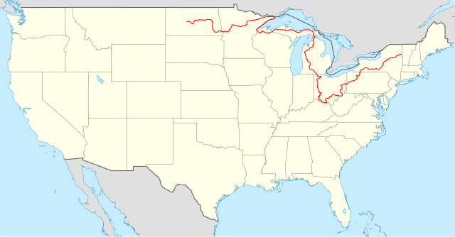
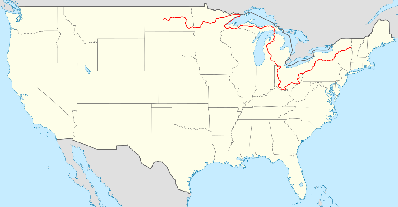
Locator map of the United States ("lower 48") with the North Country Trail overlayed. Equirectangular projection, N/S stretching 120 %. Geographic limits of the map:
|
| 日期 | (UTC) |
| 來源 |
|
| 作者 |
|
此檔案採用共享創意 姓名標示-相同方式分享 3.0 未在地化版本授權條款。
- 您可以自由:
- 分享 – 複製、發佈和傳播本作品
- 重新修改 – 創作演繹作品
- 惟需遵照下列條件:
- 姓名標示 – 您必須指名出正確的製作者,和提供授權條款的連結,以及表示是否有對內容上做出變更。您可以用任何合理的方式來行動,但不得以任何方式表明授權條款是對您許可或是由您所使用。
- 相同方式分享 – 如果您利用本素材進行再混合、轉換或創作,您必須基於如同原先的相同或兼容的條款,來分布您的貢獻成品。
原始上傳日誌
This image is a derivative work of the following image:
- File:USA_location_map.svg licensed with Cc-by-sa-3.0, GFDL
- 2008-07-29T20:04:42Z NordNordWest 1859x968 (738148 Bytes) {{Information |Description= {{de|Positionskarte der [[:de:Vereinigte Staaten|Vereinigten Staaten]]}} Quadratische Plattkarte, N-S-Streckung 120 %. Geographische Begrenzung der Karte: * N: 49.8° N * S: 24.2° N * W: 125.5° W
Uploaded with derivativeFX
檔案歷史
點選日期/時間以檢視該時間的檔案版本。
| 日期/時間 | 縮圖 | 尺寸 | 用戶 | 備註 | |
|---|---|---|---|---|---|
| 目前 | 2023年12月30日 (六) 20:01 | | 1,859 × 968(691 KB) | Bamyers99 | Removed segment in Minnesota |
| 2011年2月9日 (三) 03:54 |  | 1,859 × 968(678 KB) | Bamyers99 | {{Information |Description=Locator map of the United States ("lower 48") with the North Country Trail overlayed. Equirectangular projection, N/S stretching 120 %. Geographic limits of the map: * N: 49.8° |
檔案用途
下列頁面有用到此檔案:
全域檔案使用狀況
以下其他 wiki 使用了這個檔案:
- de.wikipedia.org 的使用狀況
- en-two.iwiki.icu 的使用狀況
- fr.wikipedia.org 的使用狀況
- it.wikipedia.org 的使用狀況
- www.wikidata.org 的使用狀況