
File:PIA23377-MarsCuriosityRover-MovesAcrossClayUnit-20190720.gif

原始檔案 (1,560 × 1,254 像素,檔案大小:3.27 MB,MIME 類型:image/gif、循環、2 畫格、4.0秒)
摘要
| 描述 |
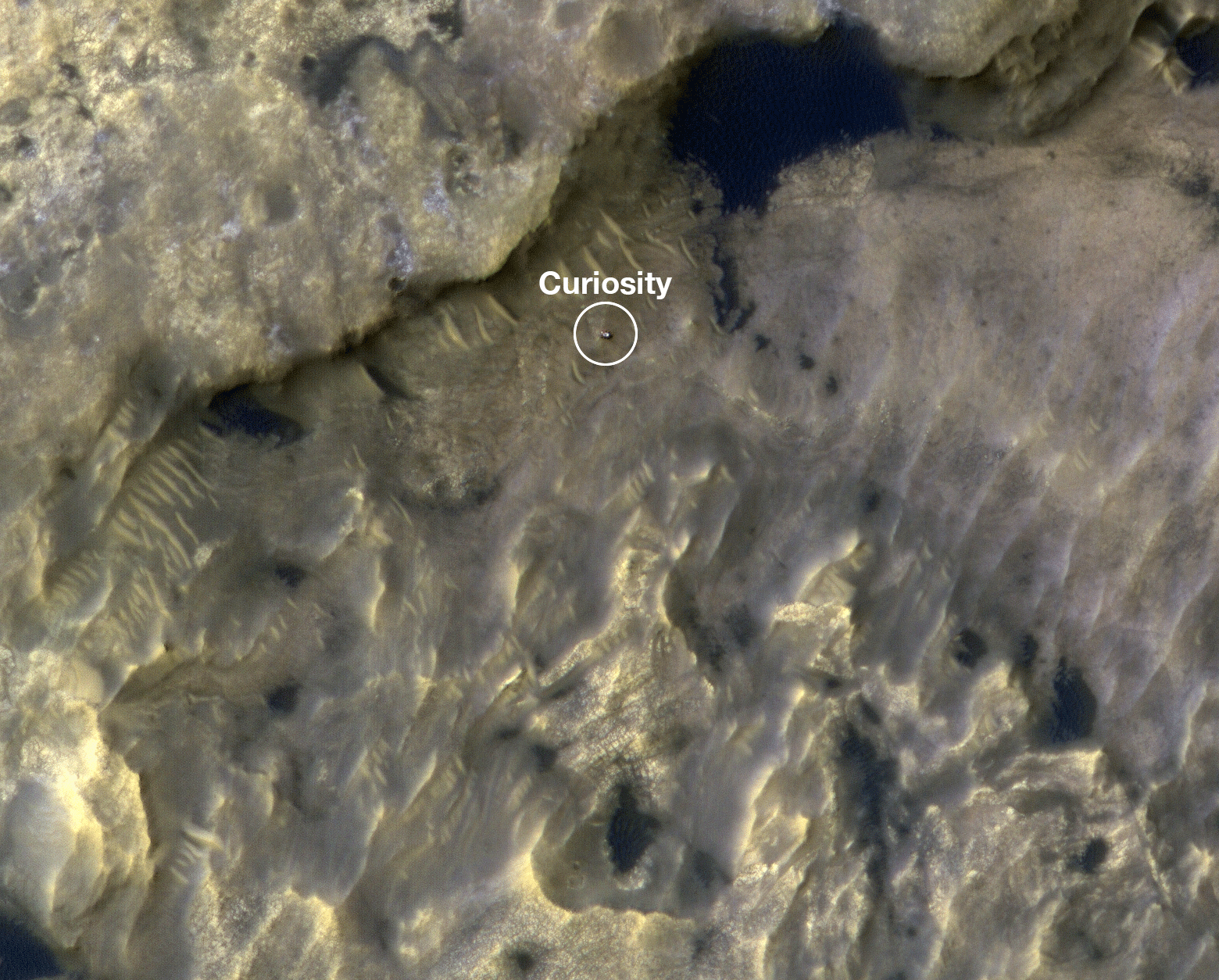
English: PIA23377: HiRISE Watches Curiosity Journey Across the Clay Unit
https://photojournal.jpl.nasa.gov/catalog/PIA23377 https://www.jpl.nasa.gov/news/news.php?feature=7518 This animation shows the position of NASA's Curiosity rover as it journeyed 1,106 feet (337 meters) through an area of Mount Sharp called "the clay-bearing unit" between May 31 and July 20, 2019. Each of these two images were taken by the HiRISE camera on NASA's Mars Reconnaissance Orbiter. The first image shows the rover, which appears as a gray speck, at a location called "Woodland Bay" (top center). The second shows "Sandside Harbour" (bottom center, near the dark sand patch). Look carefully and you can even see the rover's tracks arcing to the right of the second image. NASA's Jet Propulsion Laboratory, a division of Caltech in Pasadena, California, manages the Mars Reconnaissance Orbiter Project as well as the Curiosity mission for NASA's Science Mission Directorate, Washington. The University of Arizona, in Tucson, operates HiRISE, which was built by Ball Aerospace & Technologies Corp., in Boulder, Colorado. |
| 日期 | |
| 來源 | https://photojournal.jpl.nasa.gov/archive/PIA23377.gif |
| 作者 | NASA/JPL-Caltech/University of Arizona |
授權條款
| 本作品由NASA創作,屬於公有領域。根據NASA的版權政策:“NASA的創作除非另有聲明否則不受版權保護。”(參見:Template:PD-USGov/zh,NASA版權政策或JPL圖像使用政策) | ||
 |
警告:
|
檔案歷史
點選日期/時間以檢視該時間的檔案版本。
| 日期/時間 | 縮圖 | 尺寸 | 用戶 | 備註 | |
|---|---|---|---|---|---|
| 目前 | 2019年10月16日 (三) 21:46 | | 1,560 × 1,254(3.27 MB) | Drbogdan | User created page with UploadWizard |
檔案用途
下列頁面有用到此檔案:
全域檔案使用狀況
以下其他 wiki 使用了這個檔案:
- en-two.iwiki.icu 的使用狀況