
File:Pacific crest trail route overview.png
預覽大小:291 × 600 像素。 其他解析度:116 × 240 像素 | 233 × 480 像素 | 372 × 768 像素 | 497 × 1,024 像素 | 1,446 × 2,980 像素。
原始檔案 (1,446 × 2,980 像素,檔案大小:1.79 MB,MIME 類型:image/png)
摘要
| 描述 |
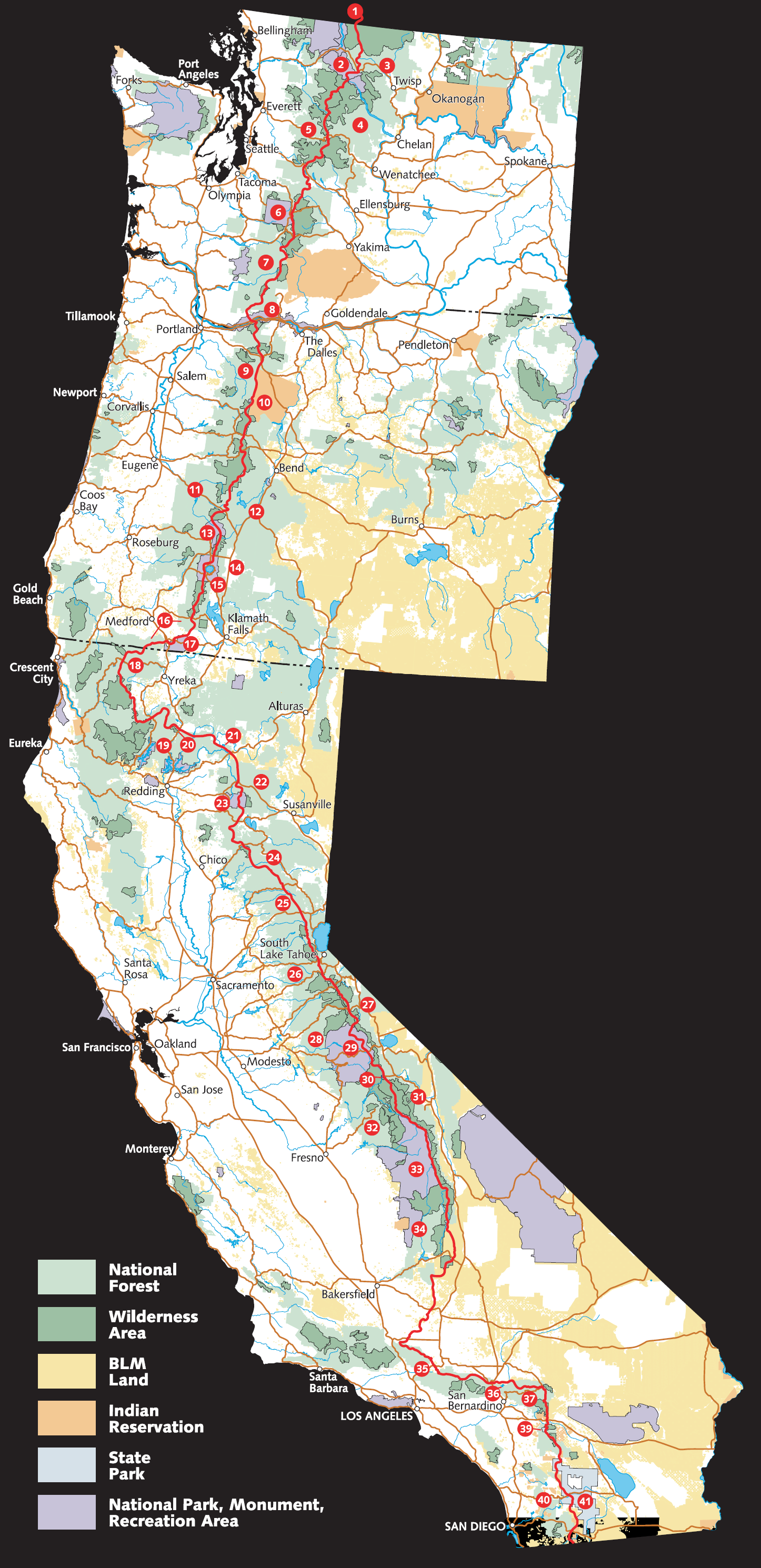
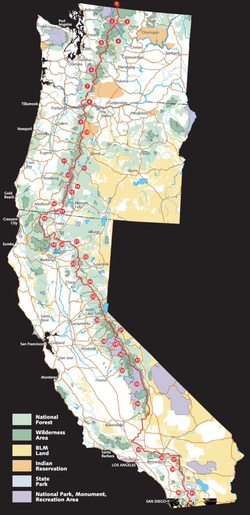
English: Schematic overview of the Pacific Crest Trail route, adjacent federal lands, and landscape. (BLM stands for Bureau of Land Management.) |
| 來源 | Adapted from https://web.archive.org/web/20060624223438/http://www.fs.fed.us/pct/pdf/Large_PCT_Map.pdf |
| 作者 | w:USFS and EncMstr |
授權條款
此作品在美國屬於公有領域,因為其是由美國政府的官員或僱員,基於其個人公務目的製作的作品,參考美國法典第17篇第1章第105條。
注意︰本模板僅適用於美國聯邦政府的原創作品,不適用於任何美國州、屬地、聯邦個體、縣、市或任何次級政府的作品。本模板也不適用於1978年以後由美國郵政署出版的郵票圖案(參看美國版權局實踐綱領第313.6(C)(1)條)。也不適用於部分美國硬幣;參看美國鑄幣局使用條款。 |
 | |
| 此作品無已知的著作權限制,亦不受所有相關和鄰接的權利限制。 | ||
檔案歷史
點選日期/時間以檢視該時間的檔案版本。
| 日期/時間 | 縮圖 | 尺寸 | 用戶 | 備註 | |
|---|---|---|---|---|---|
| 目前 | 2006年10月1日 (日) 18:17 | | 1,446 × 2,980(1.79 MB) | EncMstr | {{Information |Description=Schematic overview of course and lands of the w:Pacific Crest Trail |Source=Adapted from http://www.fs.fed.us/pct/pdf/Large_PCT_Map.pdf |Date=2006-04-26 |Author=w:USFS and EncMstr |Permission= |other_versions= }} |
檔案用途
全域檔案使用狀況
以下其他 wiki 使用了這個檔案:
- bg.wikipedia.org 的使用狀況
- en-two.iwiki.icu 的使用狀況
- en.wikivoyage.org 的使用狀況
- es.wikipedia.org 的使用狀況
- fa.wikipedia.org 的使用狀況
- fr.wikipedia.org 的使用狀況
- he.wikipedia.org 的使用狀況
- it.wikipedia.org 的使用狀況
- nl.wikipedia.org 的使用狀況
- no.wikipedia.org 的使用狀況
- pl.wikipedia.org 的使用狀況
- pt.wikipedia.org 的使用狀況
- ru.wikipedia.org 的使用狀況
- www.wikidata.org 的使用狀況