
File:Final route of the SS Princess Alice.svg

此 SVG 檔案的 PNG 預覽的大小:800 × 360 像素。 其他解析度:320 × 144 像素 | 640 × 288 像素 | 1,024 × 461 像素 | 1,280 × 576 像素 | 2,560 × 1,152 像素 | 2,189 × 985 像素。
原始檔案 (SVG 檔案,表面大小:2,189 × 985 像素,檔案大小:514 KB)
摘要
| 描述 |
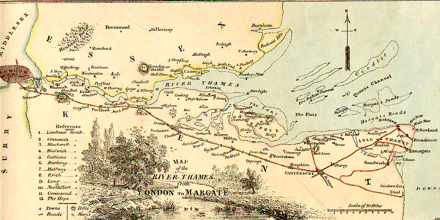
English: The route of the SS Princess Alice, showing the position she sank |
|||
| 日期 | ||||
| 來源 |
自己的作品
Derived from; Information from: |
|||
| 作者 | Goran tek-en, following request by SchroCat | |||
| 授權許可 (重用此檔案) |
此檔案採用共享創意 姓名標示-相同方式分享 4.0 國際授權條款。 姓名標示: Goran tek-en
|
|||
| 其他版本 |
|
|||
| SVG開發 |

檔案歷史
點選日期/時間以檢視該時間的檔案版本。
| 日期/時間 | 縮圖 | 尺寸 | 用戶 | 備註 | |
|---|---|---|---|---|---|
| 目前 | 2019年3月3日 (日) 17:50 | | 2,189 × 985(514 KB) | Goran tek-en | {{Information |description ={{en|1=The route of the ''SS Princess Alice'', showing the position she sank}} |date =20190303 |source ={{Own}}<br> {{Derived from|Route of the Princess Alice.jpg|1855 Colton Map of London, England - Geographicus - London-cbl-1855.jpg|England location map.svg}} Derived from; * [https://www.openstreetmap.org/#map=11/51.4703/0.4316 OSM] Information from: * [https://support.bl.uk/DynamicImages/43ac8c6b-6d73-498b-b70b-a45e01440034/Thomas-Milnes-... |
檔案用途
下列頁面有用到此檔案:
全域檔案使用狀況
以下其他 wiki 使用了這個檔案:
- en-two.iwiki.icu 的使用狀況
- es.wikipedia.org 的使用狀況
- he.wikipedia.org 的使用狀況
- it.wikipedia.org 的使用狀況
- ja-two.iwiki.icu 的使用狀況
- ko.wikipedia.org 的使用狀況
- ru.wikipedia.org 的使用狀況