
File:NSW & QLD bushfires Dec 17, 2019.png
預覽大小:800 × 450 像素。 其他解析度:320 × 180 像素 | 640 × 360 像素 | 1,024 × 576 像素 | 1,280 × 720 像素 | 1,920 × 1,080 像素。
原始檔案 (1,920 × 1,080 像素,檔案大小:3.59 MB,MIME 類型:image/png)
摘要
| 描述 |
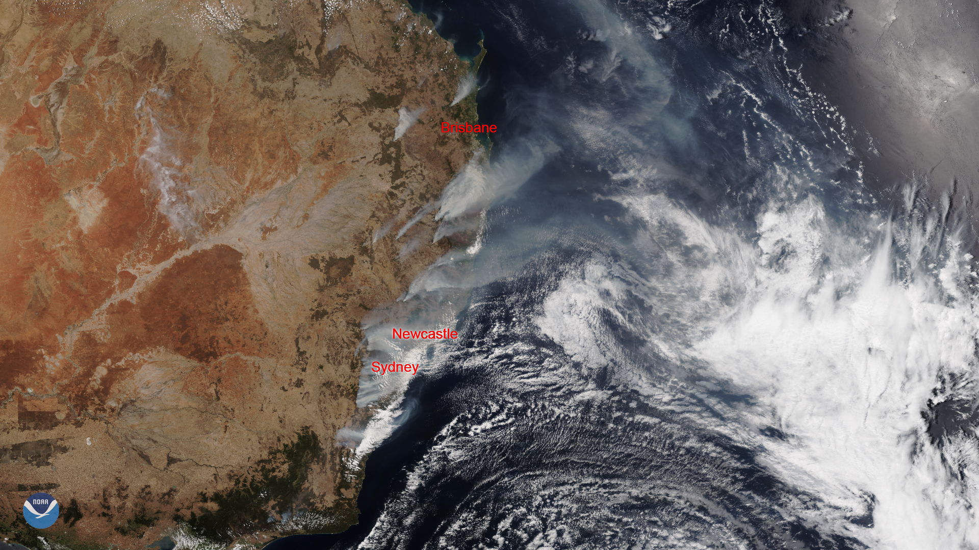
English: This image was captured by the NOAA-20 satellite's VIIRS instrument, which scans the entire Earth twice per day at a 750-meter resolution. Multiple visible and infrared channels allow it to detect atmospheric aerosols, such as dust, smoke and haze associated with industrial pollution and fires. The polar-orbiting satellite circles the globe 14 times daily and captures a complete daytime view of our planet once every 24 hours.
中文:該圖像由NOAA-20衛星的VIIRS儀器捕獲,該儀器每天以750米的分辨率掃描整個地球兩次。 多個可見和紅外通道使它能夠檢測大氣中的氣溶膠,例如與工業污染和火災相關的灰塵,煙霧和霾。 極地軌道衛星每天繞地球飛行14次,每24小時捕獲一次我們星球的完整白天視圖。 |
| 日期 | |
| 來源 | https://www.nesdis.noaa.gov/content/australian-wildfires-continue-burn-amid-heat-wave |
| 作者 | NOAA / NESDIS |
授權條款
本圖像屬於公有領域,因該作品最初來自於美國國家海洋和大氣管理局職員的職務作品。
|
檔案歷史
點選日期/時間以檢視該時間的檔案版本。
| 日期/時間 | 縮圖 | 尺寸 | 用戶 | 備註 | |
|---|---|---|---|---|---|
| 目前 | 2020年1月6日 (一) 08:18 | | 1,920 × 1,080(3.59 MB) | A1Cafel | User created page with UploadWizard |
檔案用途
下列頁面有用到此檔案:
全域檔案使用狀況
以下其他 wiki 使用了這個檔案:
- ar.wikipedia.org 的使用狀況
- ca.wikipedia.org 的使用狀況
- ckb.wikipedia.org 的使用狀況
- es.wikipedia.org 的使用狀況
- eu.wikipedia.org 的使用狀況
- ga.wikipedia.org 的使用狀況
- he.wikipedia.org 的使用狀況
- nah.wikipedia.org 的使用狀況
- szy.wikipedia.org 的使用狀況
- www.wikidata.org 的使用狀況
- zh-yue.wikipedia.org 的使用狀況