
File:CA 11thCD clip.png
此为最大尺寸。
CA_11thCD_clip.png (255 × 300像素,文件大小:29 KB,MIME类型:image/png)
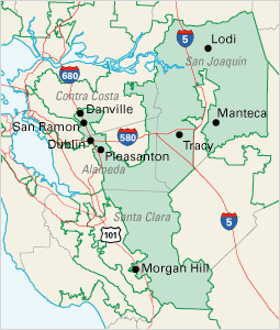
| 描述 | Clip of en:Image:Ca11 108.gif California Congressional District 11, from U.S. National Atlas (printable congressional districts map section) | |||
| 来源 | National Atlas of the United States | |||
| 作者 | United States Department of the Interior | |||
| 授权 (二次使用本文件) |
|
原始上传日志
The original description page was here. All following user names refer to en.wikipedia.
- 2004-12-12 03:12 Leonard G. 255×300×8 (29872 bytes) Clip of [[Image:Ca11 108.gif]]
文件历史
点击某个日期/时间查看对应时刻的文件。
| 日期/时间 | 缩略图 | 大小 | 用户 | 备注 | |
|---|---|---|---|---|---|
| 当前 | 2006年12月4日 (一) 14:54 | | 255 × 300(29 KB) | Shyam | {{Information |Description=Clip of en::Image:Ca11 108.gif California Congressional District 11, from [http://nationalatlas.gov/congdistprint.html U.S. National Atlas (printable congressional districts map section)] |Source=Originally from [http://en |
文件用途
全域文件用途
以下其他wiki使用此文件:
- en-two.iwiki.icu上的用途
- es.wikipedia.org上的用途
- hu.wikipedia.org上的用途
- ja-two.iwiki.icu上的用途
- nl.wikipedia.org上的用途
- pt.wikipedia.org上的用途
- www.wikidata.org上的用途