
File:County Down UK location map.svg

此SVG文件的PNG预览的大小:548 × 600像素。 其他分辨率:219 × 240像素 | 439 × 480像素 | 702 × 768像素 | 936 × 1,024像素 | 1,871 × 2,048像素 | 742 × 812像素。
原始文件 (SVG文件,尺寸为742 × 812像素,文件大小:1.73 MB)
| 描述 |
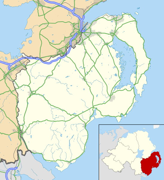
Map of County Down, UK with the following information shown:
Geographic limits:
|
|||
| 日期 | ||||
| 来源 |
Ordnance Survey of Northern Ireland OpenData
Ordnance Survey OpenData
|
|||
| 作者 | Nilfanion, created using OSNI data | |||
| 授权 (二次使用本文件) |
本文件采用知识共享署名-相同方式共享 3.0 未本地化版本许可协议授权。 署名: Contains LPS Intellectual Property and Ordnance Survey data © Crown copyright and database right 2016
|
文件历史
点击某个日期/时间查看对应时刻的文件。
| 日期/时间 | 缩略图 | 大小 | 用户 | 备注 | |
|---|---|---|---|---|---|
| 当前 | 2016年5月15日 (日) 12:45 | | 742 × 812(1.73 MB) | Nilfanion | {{Information |Description=Map of County Down, UK with the following information shown: *Administrative borders *Coastline, lakes and rivers *Roads and railways *Urban areas Equirectangular map projection on WGS 84 datum, with N/S s... |
文件用途
以下6个页面使用本文件:
全域文件用途
以下其他wiki使用此文件:
- en-two.iwiki.icu上的用途
- Downpatrick
- Newcastle, County Down
- Newtownards
- List of monastic houses in Ireland
- Bangor, County Down
- Dundrum, County Down
- Ardglass
- Donaghadee
- Warrenpoint
- Rostrevor
- Portaferry
- Kilkeel
- Killyleagh
- Comber
- Copeland Islands
- Royal Hillsborough
- Kircubbin, County Down
- Burr Point
- Carryduff
- Holywood, County Down
- Ballynahinch, County Down
- Crossgar
- Castlewellan
- Saintfield
- Annalong
- Slieve Donard
- Silent Valley Reservoir
- Magheralin
- Dromore, County Down
- Mayobridge
- Mazetown
- Hilltown, County Down
- Bangor Abbey
- Lurganare
- Millisle
- Ulster Folk and Transport Museums
- Dundonald, County Down
- Groomsport
- Ballela
- Kinallen
- Portavogie
- Bleary
- Gilford, County Down
- Loughinisland
- Strangford
- Páirc Esler
- Ballynoe, County Down
- Helen's Bay
- Rathfriland
- Cultra
查看此文件的更多全域用途。