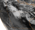
File:032606 Cocos Islands Low.PNG
外觀
032606_Cocos_Islands_Low.PNG (285 × 236 像素,檔案大小:94 KB,MIME 類型:image/png)
檔案歷史
點選日期/時間以檢視該時間的檔案版本。
| 日期/時間 | 縮圖 | 尺寸 | 使用者 | 備註 | |
|---|---|---|---|---|---|
| 目前 | 2008年4月17日 (四) 18:40 |  | 285 × 236(94 KB) | Hurricanehink | {{Information |Description=Satellite image of Tropical Low near Cocos Islands on March 26, 2006 |Source=ftp://eclipse.ncdc.noaa.gov/pub/isccp/b1/.D2790P/images/2006/085/Img-2006-03-26-15-MTS-1-IR.jpg |Author=Meteosat Satellite |Date=2006-03-26 |Permission |
| 2008年4月17日 (四) 18:39 |  | 335 × 288(161 KB) | Hurricanehink | {{Information |Description=Satellite image of Tropical Low near Cocos Islands on March 26, 2006 |Source=ftp://eclipse.ncdc.noaa.gov/pub/isccp/b1/.D2790P/images/2006/085/Img-2006-03-26-15-MTS-1-IR.jpg |Author=Meteosat Satellite |Date=2006-03-26 |Permission |
檔案用途
下列頁面有用到此檔案:
全域檔案使用狀況
以下其他 wiki 使用了這個檔案:
- pt.wikipedia.org 的使用狀況


