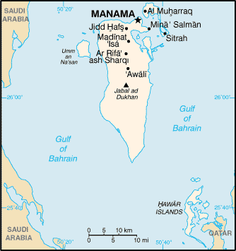
File:Bahrain map.png
外觀
Bahrain_map.png (334 × 355 像素,檔案大小:9 KB,MIME 類型:image/png)
檔案歷史
點選日期/時間以檢視該時間的檔案版本。
| 日期/時間 | 縮圖 | 尺寸 | 使用者 | 備註 | |
|---|---|---|---|---|---|
| 目前 | 2005年5月21日 (六) 14:48 |  | 334 × 355(9 KB) | Nord68 | {{PD-USGov-CIA-WF}} |
檔案用途
全域檔案使用狀況
以下其他 wiki 使用了這個檔案:
- af.wikipedia.org 的使用狀況
- als.wikipedia.org 的使用狀況
- ar.wikipedia.org 的使用狀況
- ast.wikipedia.org 的使用狀況
- ast.wiktionary.org 的使用狀況
- az.wikipedia.org 的使用狀況
- ban.wikipedia.org 的使用狀況
- be-tarask.wikipedia.org 的使用狀況
- bg.wiktionary.org 的使用狀況
- bn.wikipedia.org 的使用狀況
- ca.wikipedia.org 的使用狀況
- ckb.wikipedia.org 的使用狀況
- cs.wikipedia.org 的使用狀況
- cy.wikipedia.org 的使用狀況
- de.wikipedia.org 的使用狀況
- de.wiktionary.org 的使用狀況
- el.wikipedia.org 的使用狀況
- en-two.iwiki.icu 的使用狀況
- List of cities in Bahrain
- Gulf of Bahrain
- Sitra
- History of the Jews in Bahrain
- Territorial disputes in the Persian Gulf
- 2011 Bahraini uprising
- Energy in Bahrain
- User:Morriswa/My OCONUS travel
- Karim Fakhrawi
- Module:Location map/data/Bahrain/doc
- User:Chickstarr404/Gather lists/13386 – "A Travelers Alphabet" by Stephen Runciman
- Module:Location map/data/Bahrain
- en.wikibooks.org 的使用狀況
- en.wikisource.org 的使用狀況
- en.wiktionary.org 的使用狀況
- es.wikipedia.org 的使用狀況
- es.wikibooks.org 的使用狀況
- fa.wikipedia.org 的使用狀況
- fi.wikipedia.org 的使用狀況
檢視此檔案的更多全域使用狀況。


