
File:Ivory Coast March 2011 offensive map.png
原始檔案 (2,366 × 2,911 像素,檔案大小:662 KB,MIME 類型:image/png)
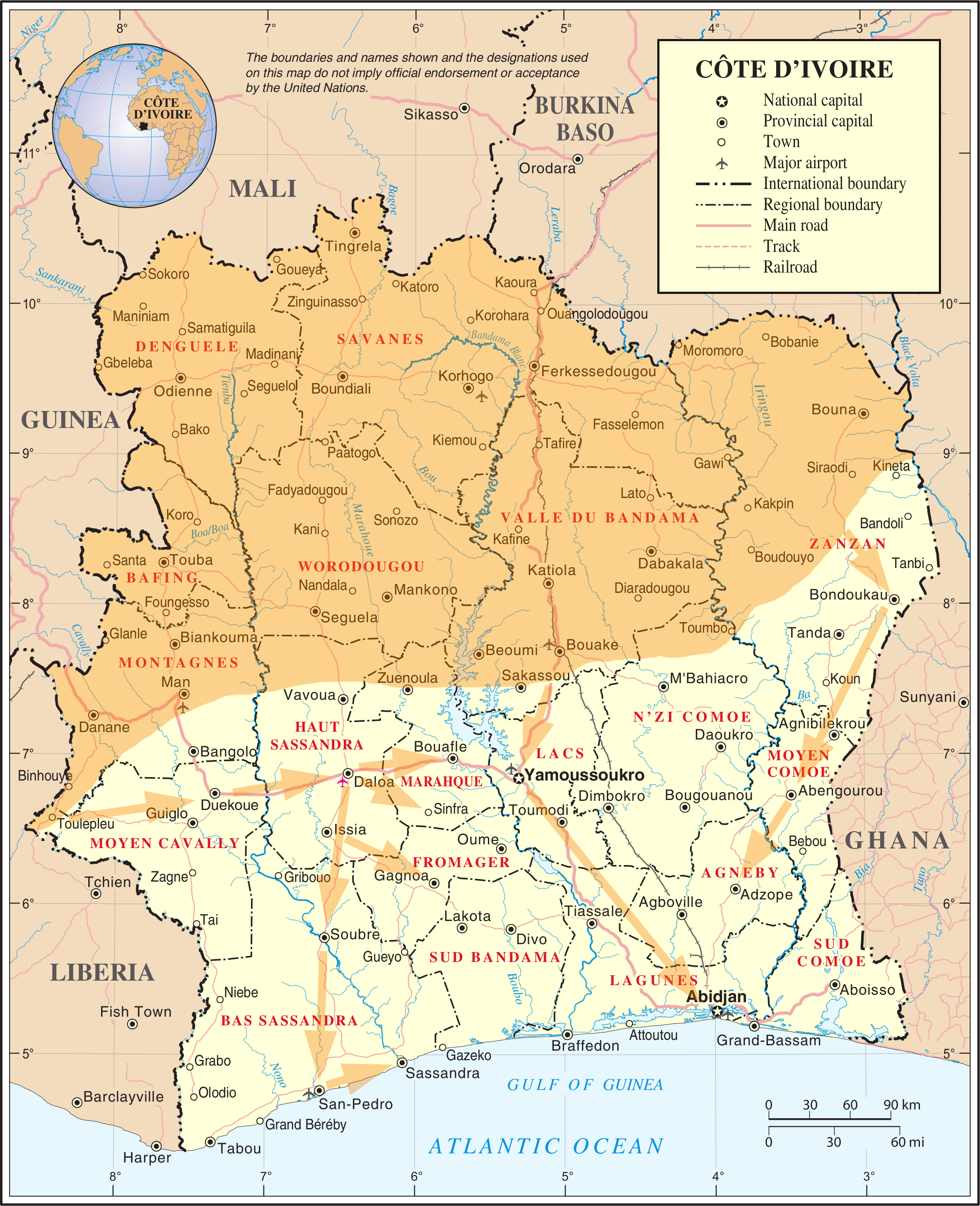
| 描述 |
English: Map of the March 2011 Republican Forces offensive in Ivory Coast |
|||
| 日期 | ||||
| 來源 | Adapted from File:Un-cotedivoire.png | |||
| 作者 | User:Prioryman | |||
| 授權許可 (重用此檔案) |
|

檔案歷史
點選日期/時間以檢視該時間的檔案版本。
| 日期/時間 | 縮圖 | 尺寸 | 使用者 | 備註 | |
|---|---|---|---|---|---|
| 目前 | 2011年4月1日 (五) 02:12 | | 2,366 × 2,911(662 KB) | Prioryman | Added new arrows |
| 2011年4月1日 (五) 01:32 |  | 2,366 × 2,911(661 KB) | Prioryman | Amended arrows | |
| 2011年4月1日 (五) 00:55 |  | 2,366 × 2,911(661 KB) | Prioryman | Amended arrows | |
| 2011年4月1日 (五) 00:53 |  | 2,366 × 2,911(659 KB) | Prioryman | Amended arrows | |
| 2011年3月31日 (四) 23:14 |  | 2,366 × 2,911(648 KB) | Prioryman | {{Information |Description ={{en|1=Map of the March 2011 Republican Forces offensive in Ivory Coast}} |Source =Adapted from File:Un-cotedivoire.png |Author =User:Prioryman |Date =2011/04/01 |Permission ={{UN map}} |
檔案用途
下列頁面有用到此檔案:
全域檔案使用狀況
以下其他 wiki 使用了這個檔案:
- ar.wikipedia.org 的使用狀況
- be.wikipedia.org 的使用狀況
- ca.wikipedia.org 的使用狀況
- cs.wikipedia.org 的使用狀況
- de.wikipedia.org 的使用狀況
- el.wikinews.org 的使用狀況
- en-two.iwiki.icu 的使用狀況
- es.wikipedia.org 的使用狀況
- es.wikinews.org 的使用狀況
- fr.wikipedia.org 的使用狀況
- gl.wikipedia.org 的使用狀況
- he.wikipedia.org 的使用狀況
- hu.wikipedia.org 的使用狀況
- ka.wikipedia.org 的使用狀況
- no.wikipedia.org 的使用狀況
- pl.wikipedia.org 的使用狀況
- pt.wikipedia.org 的使用狀況
- ru.wikipedia.org 的使用狀況
- sv.wikipedia.org 的使用狀況
- www.wikidata.org 的使用狀況