
File:Otto 2016-11-24 1605Z.jpg
預覽大小:450 × 600 像素。 其他解析度:180 × 240 像素 | 360 × 480 像素 | 576 × 768 像素 | 768 × 1,024 像素 | 1,536 × 2,048 像素 | 5,100 × 6,800 像素。
原始檔案 (5,100 × 6,800 像素,檔案大小:8.81 MB,MIME 類型:image/jpeg)
摘要
| 描述 |
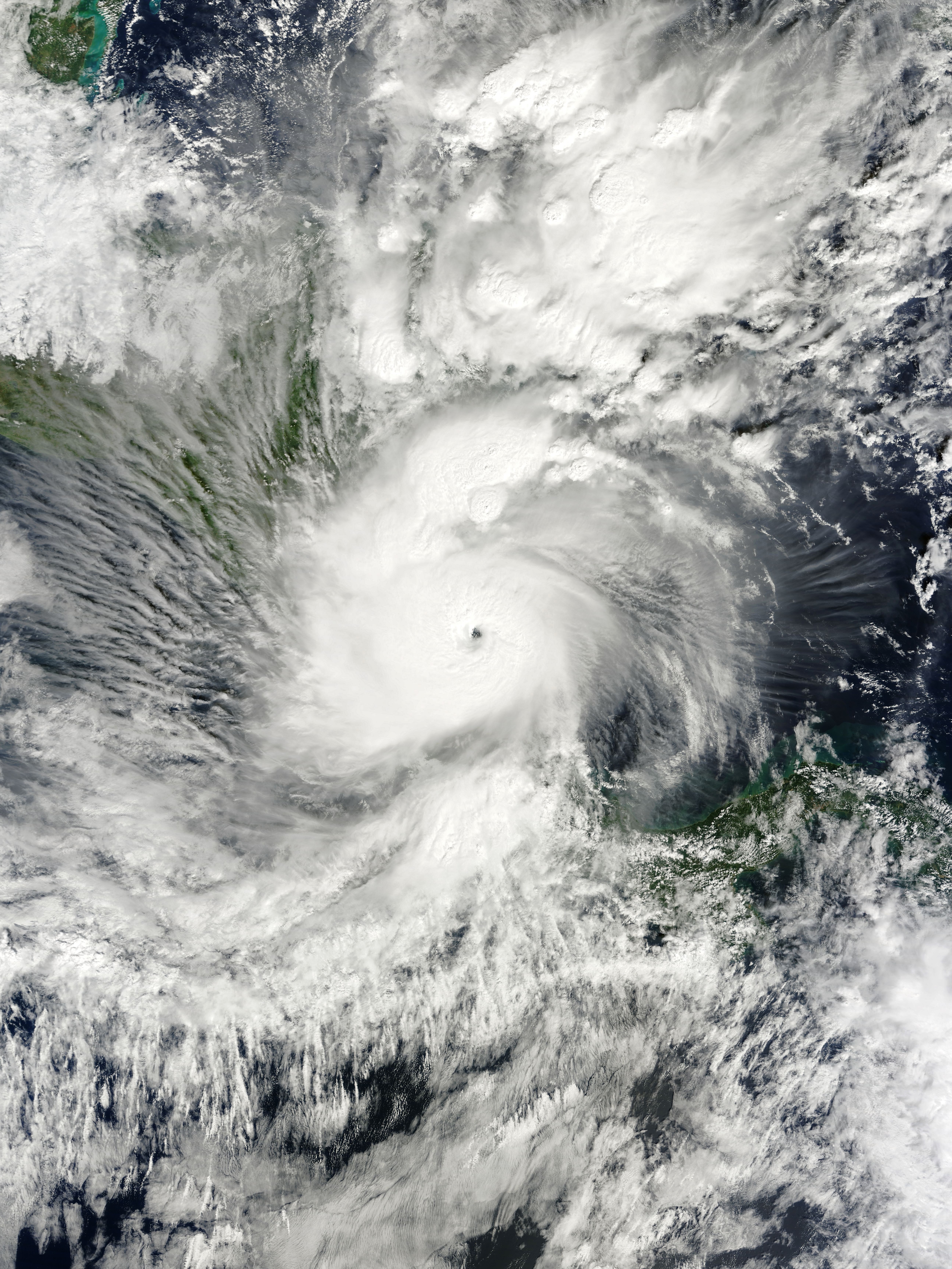
English: Hurricane Otto at peak intensity and immediately before making landfall over the southeast coast of Nicaragua on November 24, 2016. Español: El huracán Otto en su pico de intensidad y antes de tocar tierra sobre la costa sureste de Nicaragua el 24 de noviembre de 2016. |
| 日期 | |
| 來源 | EOSDIS Worldview |
| 作者 | MODIS image captured by NASA’s Terra satellite |
| 拍攝地點 | | 位於此地的本圖片與其他圖片: OpenStreetMap |
|---|
授權條款
| 本作品由NASA創作,屬於公有領域。根據NASA的版權政策:“NASA的創作除非另有聲明否則不受版權保護。”(參見:Template:PD-USGov/zh,NASA版權政策或JPL圖像使用政策) | ||
 |
警告:
|
檔案歷史
點選日期/時間以檢視該時間的檔案版本。
| 日期/時間 | 縮圖 | 尺寸 | 使用者 | 備註 | |
|---|---|---|---|---|---|
| 目前 | 2018年7月8日 (日) 05:20 | | 5,100 × 6,800(8.81 MB) | Nino Marakot | Reverted to version as of 08:12, 25 November 2016 (UTC) - Maybe this is the proposed image.... |
| 2017年11月21日 (二) 17:16 |  | 3,904 × 5,170(3.2 MB) | MarioProtIV | zoom in slightly | |
| 2016年11月25日 (五) 08:12 |  | 5,100 × 6,800(8.81 MB) | Meow | Optimised under the proper ratio. | |
| 2016年11月25日 (五) 00:23 |  | 1,160 × 1,456(263 KB) | Typhoon2013 | zoomed out | |
| 2016年11月24日 (四) 22:06 |  | 3,984 × 4,585(1.46 MB) | Byralaal | User created page with UploadWizard |
檔案用途
下列2個頁面有用到此檔案:
全域檔案使用狀況
以下其他 wiki 使用了這個檔案:
- cs.wikipedia.org 的使用狀況
- de.wikipedia.org 的使用狀況
- en-two.iwiki.icu 的使用狀況
- fi.wikipedia.org 的使用狀況
- fr.wikipedia.org 的使用狀況
- id.wikipedia.org 的使用狀況
- ja-two.iwiki.icu 的使用狀況
- ko.wikipedia.org 的使用狀況
- kw.wikipedia.org 的使用狀況
- pt.wikipedia.org 的使用狀況
- ro.wikipedia.org 的使用狀況
- ru.wikipedia.org 的使用狀況
- simple.wikipedia.org 的使用狀況
- th.wikipedia.org 的使用狀況
- uk.wikipedia.org 的使用狀況
- www.wikidata.org 的使用狀況