
File:PIA18475-MarsCuriosityRover--HIRISE-TraverseMap-PahrumpHills-20140911.jpg

預覽大小:463 × 599 像素。 其他解析度:185 × 240 像素 | 371 × 480 像素 | 593 × 768 像素 | 791 × 1,024 像素 | 2,550 × 3,300 像素。
原始檔案 (2,550 × 3,300 像素,檔案大小:3.91 MB,MIME 類型:image/jpeg)
摘要
| 描述 |
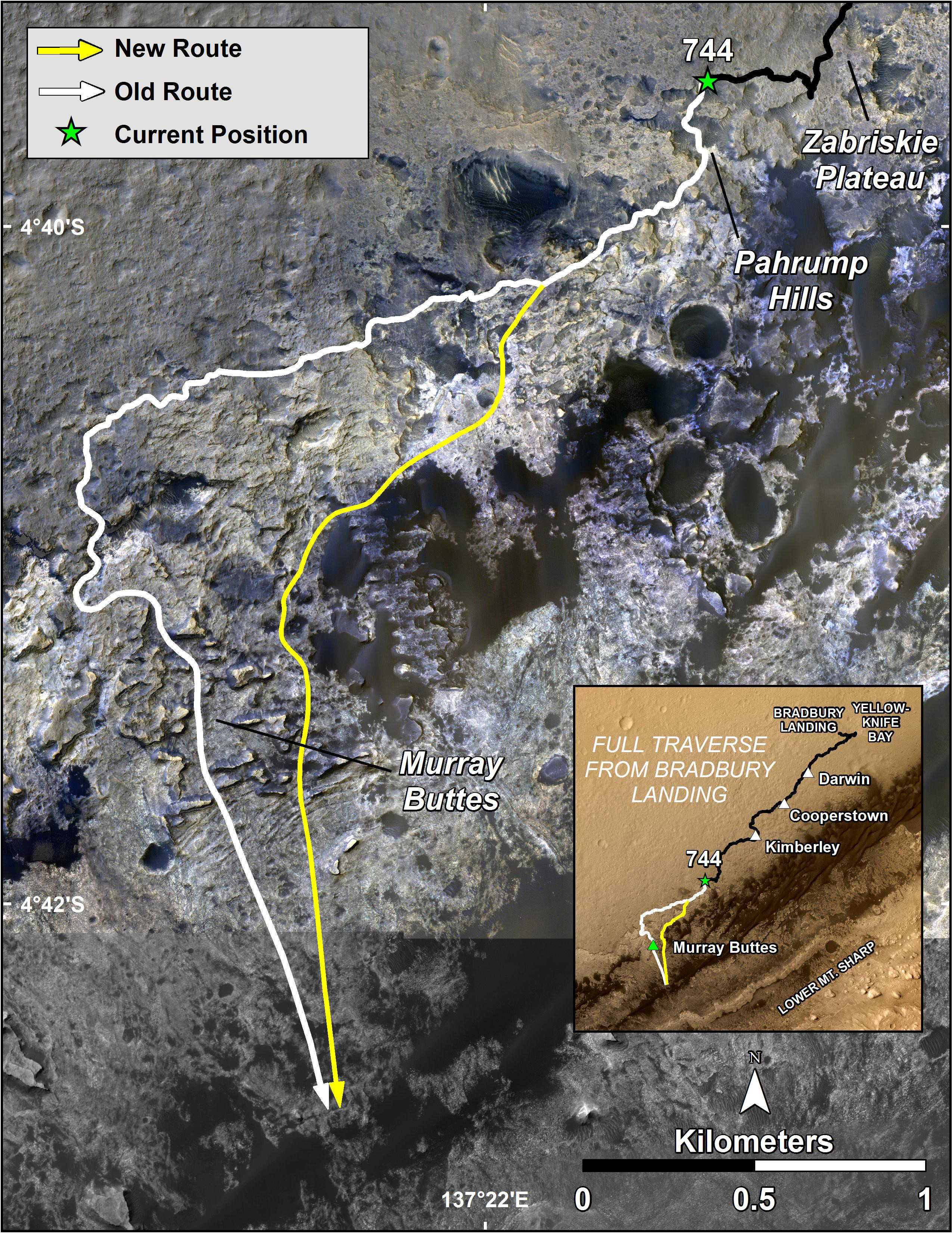
English: Geological Transition - Slopes of Aeolis Mons in Gale Crater on the planet Mars
http://mars.jpl.nasa.gov/msl/multimedia/images/?ImageID=6575 This image, taken with the High Resolution Imaging Science Experiment (HiRISE) camera, shows the transition between the "Murray Formation," in which layers are poorly expressed and difficult to trace from orbit, and the hematite ridge, which is made up of continuous layers that can be traced laterally for hundreds of meters. Orbital data shows that this change in bedding style between the Murray formation and the hematite ridge is also accompanied by a major change in layer composition. NASA's Curiosity rover will be exploring this formation. HiRISE is one of six instruments on NASA's Mars Reconnaissance Orbiter. The University of Arizona, Tucson, operates HiRISE, which was built by Ball Aerospace & Technologies Corp., Boulder, Colorado. NASA's Jet Propulsion Laboratory, a division of the California Institute of Technology in Pasadena, manages the Mars Reconnaissance Orbiter and Mars Science Laboratory projects for NASA's Science Mission Directorate, Washington. |
| 日期 | |
| 來源 | http://mars.jpl.nasa.gov/msl/images/NASA-MSL-MRO-Curiosity-Rover--HIRISE-Traverse-Map-Pahrump-Hills-pia18475-full.jpg |
| 作者 | NASA/JPL-Caltech/Univ. of Arizona |
授權條款
| 本作品由NASA創作,屬於公有領域。根據NASA的版權政策:“NASA的創作除非另有聲明否則不受版權保護。”(參見:Template:PD-USGov/zh,NASA版權政策或JPL圖像使用政策) | ||
 |
警告:
|
檔案歷史
點選日期/時間以檢視該時間的檔案版本。
| 日期/時間 | 縮圖 | 尺寸 | 使用者 | 備註 | |
|---|---|---|---|---|---|
| 目前 | 2014年9月19日 (五) 16:15 | | 2,550 × 3,300(3.91 MB) | Drbogdan | User created page with UploadWizard |
檔案用途
下列頁面有用到此檔案:
全域檔案使用狀況
以下其他 wiki 使用了這個檔案:
- en-two.iwiki.icu 的使用狀況
- tr.wikipedia.org 的使用狀況
- uk.wikipedia.org 的使用狀況