
File:TNA-400.jpg
預覽大小:800 × 600 像素。 其他解析度:320 × 240 像素 | 640 × 480 像素 | 1,024 × 768 像素 | 1,280 × 960 像素 | 1,600 × 1,200 像素。
原始檔案 (1,600 × 1,200 像素,檔案大小:432 KB,MIME 類型:image/jpeg)
摘要
| 描述 |
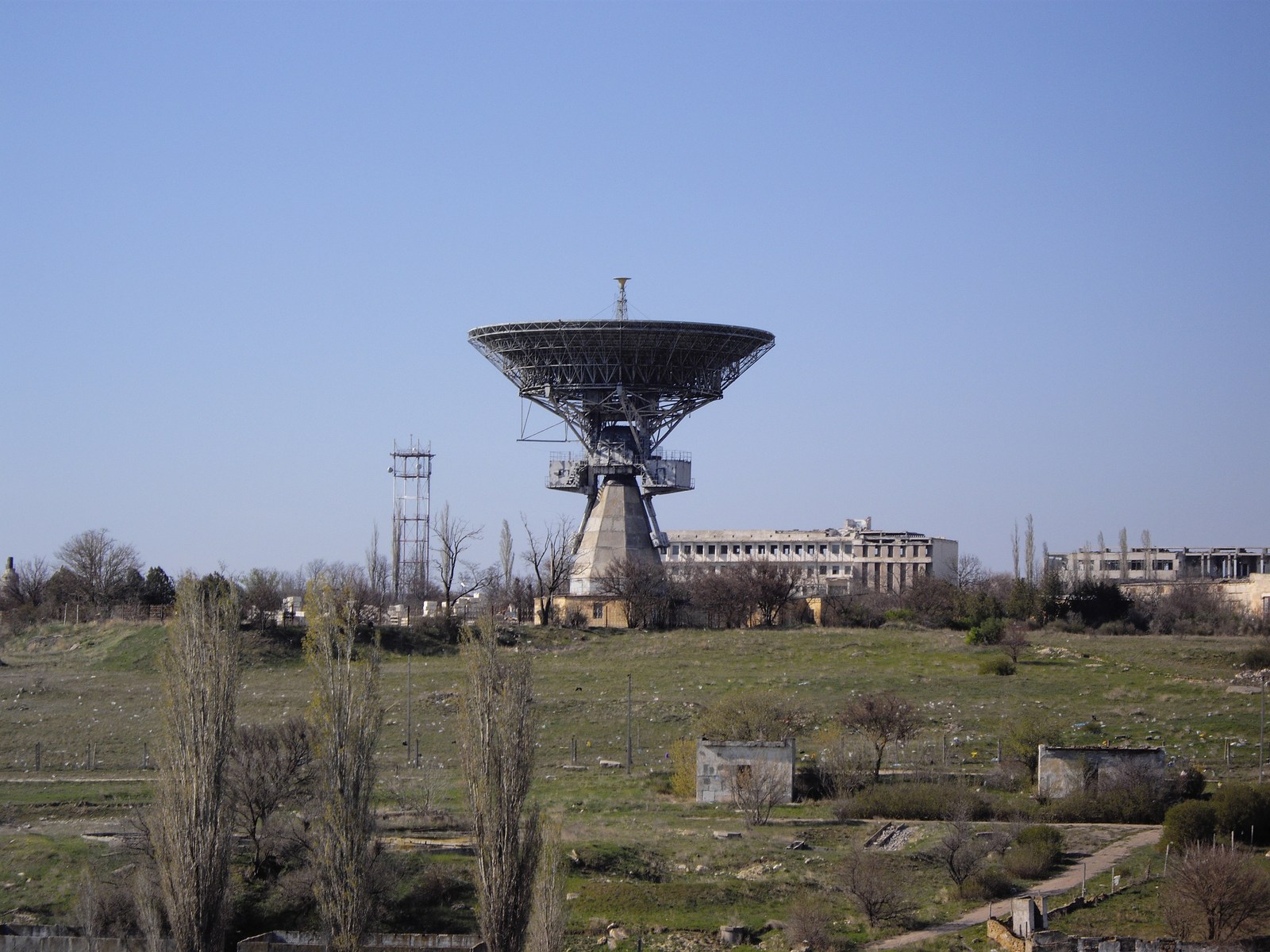
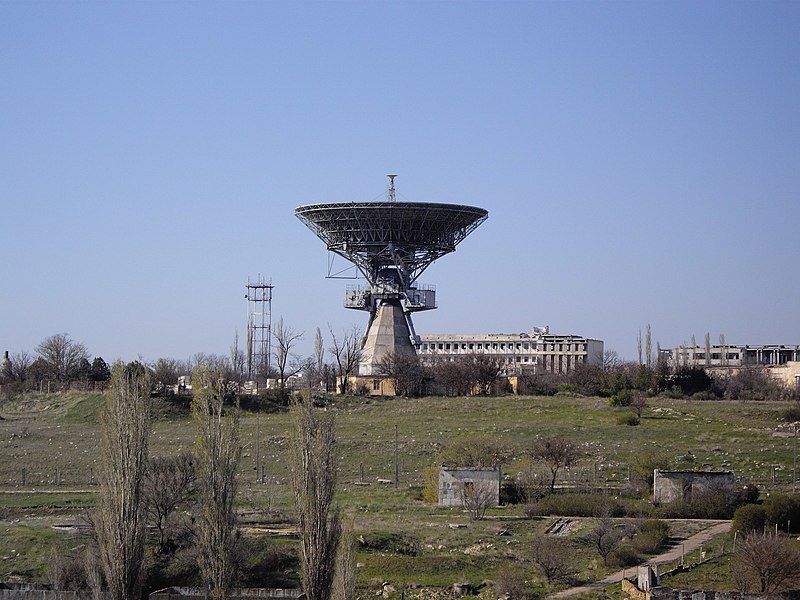
English: This component is located in the southern portion of the main operations area. It consists of a 105-foot tracking dish mounted on an azimuth/elevation pedestal, a large U-shaped control building, control/support buildings, and several small support buildings. Adjacent to the antenna and on two sides arc rosette patterns of devices/structures which are used when the dish has been lowered for maintenance or modification. A crane used to lower and erect the dish is present on the latest coverage. A 105-foot dish antenna such as this one would permit communications and telemetry reception at lunar distances. The antenna is operational. (CIA report "Simferopol Space Flight Center". June 1969 ) |
| 日期 | |
| 來源 | 自己的作品 |
| 作者 | Rumlin |
| 拍攝地點 | | 位於此地的本圖片與其他圖片: OpenStreetMap |
|---|
授權條款
我,本作品的著作權持有者,決定用以下授權條款發佈本作品:
此檔案採用創用CC 姓名標示-相同方式分享 3.0 未在地化版本授權條款。
- 您可以自由:
- 分享 – 複製、發佈和傳播本作品
- 重新修改 – 創作演繹作品
- 惟需遵照下列條件:
- 姓名標示 – 您必須指名出正確的製作者,和提供授權條款的連結,以及表示是否有對內容上做出變更。您可以用任何合理的方式來行動,但不得以任何方式表明授權條款是對您許可或是由您所使用。
- 相同方式分享 – 如果您利用本素材進行再混合、轉換或創作,您必須基於如同原先的相同或兼容的條款,來分布您的貢獻成品。

|
已授權您依據自由軟體基金會發行的無固定段落、封面文字和封底文字GNU自由文件授權條款1.2版或任意後續版本,對本檔進行複製、傳播和/或修改。該協議的副本列在GNU自由文件授權條款中。 |
您可以選擇您需要的授權條款。
檔案歷史
點選日期/時間以檢視該時間的檔案版本。
| 日期/時間 | 縮圖 | 尺寸 | 使用者 | 備註 | |
|---|---|---|---|---|---|
| 目前 | 2009年6月16日 (二) 13:25 | | 1,600 × 1,200(432 KB) | Rumlin | {{Information |Description={{en|1=This component is located in the southern portion of the main operations area. It. consists of a 105-foot tracking dish mounted on an azimuth/elevation pedestal , a large U-shaped control building , control/support buildi |
檔案用途
下列頁面有用到此檔案:
全域檔案使用狀況
以下其他 wiki 使用了這個檔案:
- ar.wikipedia.org 的使用狀況
- de.wikipedia.org 的使用狀況
- en-two.iwiki.icu 的使用狀況
- fi.wikipedia.org 的使用狀況
- fr.wikipedia.org 的使用狀況
- he.wikipedia.org 的使用狀況
- id.wikipedia.org 的使用狀況
- it.wikipedia.org 的使用狀況
- ja-two.iwiki.icu 的使用狀況
- pt.wikipedia.org 的使用狀況
- ru.wikipedia.org 的使用狀況
- ru.wikivoyage.org 的使用狀況
- uk.wikipedia.org 的使用狀況
- vi.wikipedia.org 的使用狀況
- www.wikidata.org 的使用狀況