
File:Ugarit mapa.jpg
此為最大尺寸。
Ugarit_mapa.jpg (239 × 260 像素,檔案大小:76 KB,MIME 類型:image/jpeg)
摘要
| 描述 |
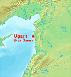
Čeština: Mapa syrské archeologické lokality Ugarit (dnešní Ras Šamra).
Při úpravě mapy byl použit software DEMIS World Map Server. English: Map of the Syrian archaeological site of Ugarit (today's Ras Shamra).
Software was used to edit the map World Map Server. |
| 日期 | 2005年4月8日 (原始上傳日期) |
| 來源 | Transferred from cs.wikipedia to Commons. |
| 作者 | 捷克文維基百科的Ansgar |
授權條款
| 此作品已由其作者,捷克文維基百科的Ansgar,釋出至公有領域。此授權條款在全世界均適用。 這可能在某些國家不合法,如果是的話: Ansgar授予任何人有權利使用此作品於任何用途,除受法律約束外,不受任何限制。 |
原始上傳日誌
The original description page was here. All following user names refer to cs.wikipedia.
- 2005-04-08 23:27 Ansgar 239×260× (78010 bytes) Mapa syrské archeologické lokality Ugarit (dnešní Ras Šamra). {{PD-self}} Při úpravě mapy byl použit software [http://www2.demis.nl/ DEMIS World Map Server].
- 2005-03-25 21:58 Ansgar 149×289× (13636 bytes) Mapa s vyznačením Ugaritu. Autorem úprav na mapě je [[Wikipedista:Ansgar|Ansgar]].
檔案歷史
點選日期/時間以檢視該時間的檔案版本。
| 日期/時間 | 縮圖 | 尺寸 | 使用者 | 備註 | |
|---|---|---|---|---|---|
| 目前 | 2010年1月19日 (二) 10:40 | | 239 × 260(76 KB) | Harold | == {{int:filedesc}} == {{Information |Description={{cs|Mapa syrské archeologické lokality Ugarit (dnešní Ras Šamra). Při úpravě mapy byl použit software [http://www2.demis.nl/ DEMIS World Map Server].}} |Source=Transferred from [http://cs.wikip |
檔案用途
下列頁面有用到此檔案:
全域檔案使用狀況
以下其他 wiki 使用了這個檔案:
- ba.wikipedia.org 的使用狀況
- ca.wikipedia.org 的使用狀況
- cs.wikipedia.org 的使用狀況
- de.wikipedia.org 的使用狀況
- en-two.iwiki.icu 的使用狀況
- es.wikipedia.org 的使用狀況
- fr.wiktionary.org 的使用狀況
- hu.wikipedia.org 的使用狀況
- ja-two.iwiki.icu 的使用狀況
- pl.wikipedia.org 的使用狀況
- pt.wikipedia.org 的使用狀況
- sk.wikipedia.org 的使用狀況
- tr.wikipedia.org 的使用狀況
- uk.wikipedia.org 的使用狀況