
File:West Virginia Congressional Districts, 113th Congress.tif

此 TIF 檔案的 PNG 預覽的大小:713 × 599 像素。 其他解析度:286 × 240 像素 | 571 × 480 像素 | 914 × 768 像素 | 1,219 × 1,024 像素 | 1,347 × 1,132 像素。
原始檔案 (1,347 × 1,132 像素,檔案大小:404 KB,MIME 類型:image/tiff)
摘要
| 描述 |
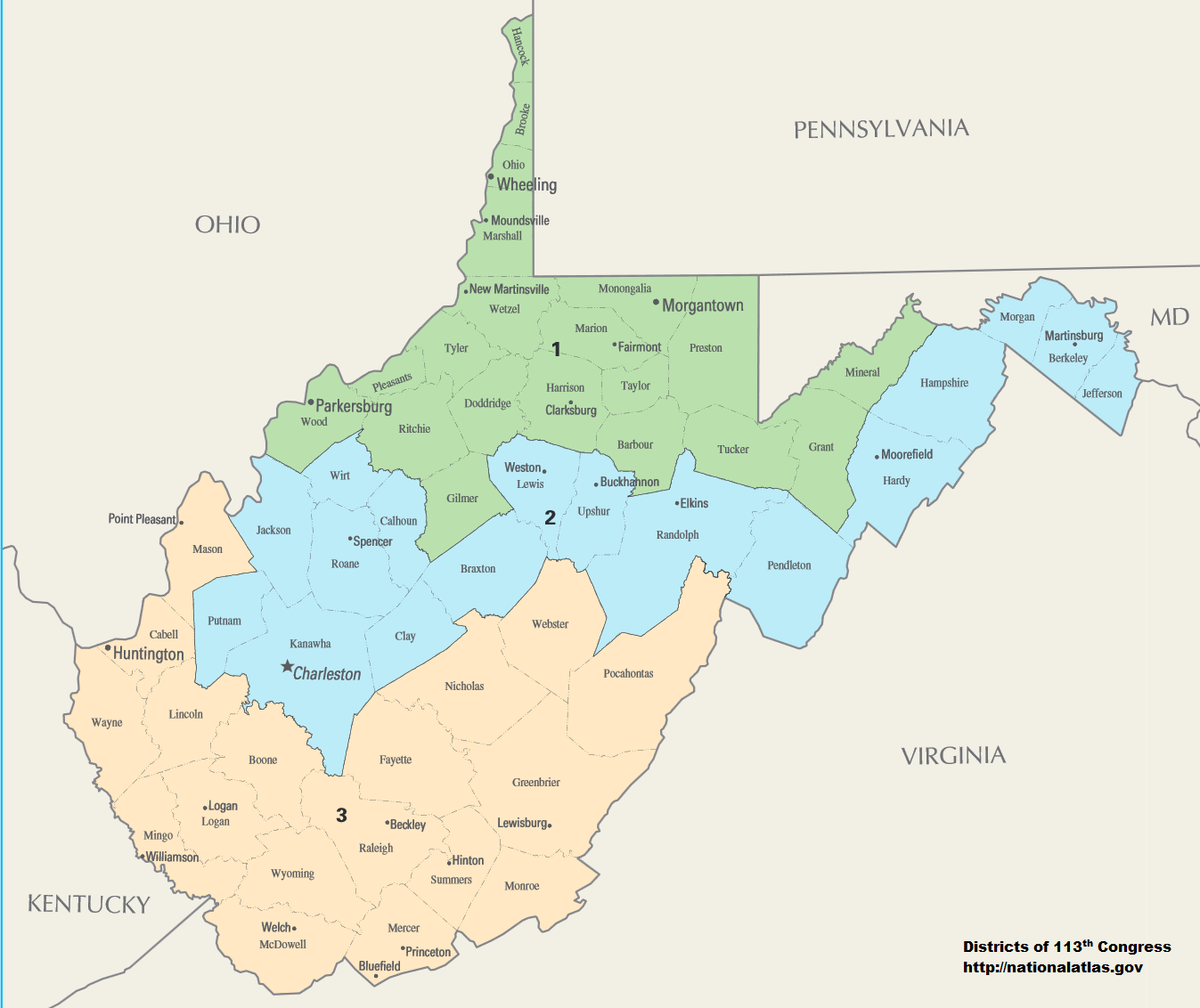
English: Map of Congressional Districts in the state of West Virginia, reflecting district boundaries current to the 113th United States Congress. |
| 日期 | |
| 來源 | National Atlas of the United States (http://nationalatlas.gov/printable/congress.html) |
| 作者 | Department of the Interior |
| 授權許可 (重用此檔案) |
This image is free information provided by the department of the interior. It was downloaded from http://nationalatlas.gov/printable/congress.html. All of that information has been provided in the captions, I'm not sure what other information is required. --7partparadigm talk 02:35, 8 February 2014 (UTC) |
授權條款
| This image or media file contains material based on a work of a United States Department of the Interior employee, created as part of that person's official duties. As a work of the U.S. federal government, such work is in the public domain in the United States. See the Department of the Interior copyright policy for more information. |  |
檔案歷史
點選日期/時間以檢視該時間的檔案版本。
| 日期/時間 | 縮圖 | 尺寸 | 使用者 | 備註 | |
|---|---|---|---|---|---|
| 目前 | 2014年2月2日 (日) 06:01 |  | 1,347 × 1,132(404 KB) | 7partparadigm | User created page with UploadWizard |
檔案用途
下列2個頁面有用到此檔案:
全域檔案使用狀況
以下其他 wiki 使用了這個檔案:
- fa.wikipedia.org 的使用狀況
- ru.wikipedia.org 的使用狀況
- uk.wikipedia.org 的使用狀況